| Mount Shaka | |
|---|---|
| 釈迦ヶ岳 | |
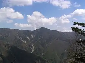
 Mount Shaka (November 2008) | |
| Highest point | |
| Elevation | 1,799.6 m (5,904 ft) |
| Listing | List of mountains and hills of Japan by height |
| Coordinates | 34°06′51″N 135°54′11″E / 34.11417°N 135.90306°E |
| Geography | |
 Mount Shaka | |
| Parent range | Ōmine Mountains |
| Topo map | Geographical Survey Institute 25000:1 釈迦ヶ岳 50000:1 和歌山 |
Mount Shaka (釈迦ヶ岳, Shaka-ga-take) is a mountain in the Ōmine Mountains in Japan. It marks part of the border between Totsukawa and Shimokitayama in Yoshino District of Nara Prefecture.
References
This article is issued from Wikipedia. The text is licensed under Creative Commons - Attribution - Sharealike. Additional terms may apply for the media files.