Naryn Region
| |
|---|---|
Region | |
 Flag  Coat of arms | |
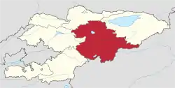 Map of Kyrgyzstan, location of Naryn Region highlighted | |
| Coordinates: 41°30′N 75°30′E / 41.500°N 75.500°E | |
| Country | |
| Capital | Naryn |
| Government | |
| • Gubernator | Omurbek Suvanaliev |
| Area | |
| • Total | 44,160 km2 (17,050 sq mi) |
| Population (2023-01-01)[1] | |
| • Total | 308,348 |
| • Density | 7.0/km2 (18/sq mi) |
| Time zone | UTC+6 (KGT) |
| ISO 3166 code | KG-N |
| Districts | 5 |
| Cities | 1 |
| Villages | 134 |

.jpg.webp)

Naryn Region (Kyrgyz: Нарын облусу, romanized: Naryn oblusu; Russian: Нарынская область, romanized: Narynskaya oblast) is the largest region (oblus) of Kyrgyzstan. It is located in the east of the country and borders with Chüy Region in the north, Issyk-Kul Region in the northeast, Xinjiang Uyghur Autonomous Region of China in the southeast, Osh Region in the southwest, and Jalal-Abad Region in the west. Its capital is Naryn. Its total area is 44,160 km2 (17,050 sq mi).[2] The resident population of the region was 292,140 as of January 2021.[1]
The main highway runs from the Chinese border at Torugart Pass north to Balykchy on Issyk-Kul Lake. It is known as the location of Song Köl Lake and Chatyr-Kul Lake and Tash Rabat.
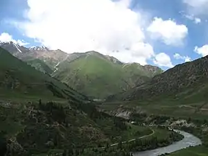
The population of Naryn oblast is 99% Kyrgyz. The economy is dominated by animal herding (sheep, horses, yaks), with wool and meat as the main products. Mining of various minerals developed during the Soviet era has largely been abandoned as uneconomical.[3] Today the oblast is considered to be the poorest region in the country, but also the most typically Kyrgyz. It boasts mountains, alpine pastures, and Song Köl Lake which during summer months attracts large herds of sheep and horses with their herders and yurts.
History
The region was established on 21 November 1939 as Tien-Shan Region. On 20 December 1962, the region was dissolved, but on 11 December 1970 it was re-established as Naryn Region. On 5 October 1988 it was merged into Issyk-Kul Region, and, finally, on 14 December 1990, the Naryn Region was re-established.[4]
Divisions
The Naryn Region is divided administratively into one city of regional significance (Naryn) and five districts:[5]
| District | Seat | Map |
|---|---|---|
| Ak-Talaa District | Baetov |  |
| At-Bashy District | At-Bashy | 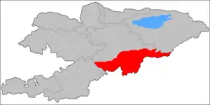 |
| Jumgal District | Chaek | 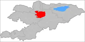 |
| Kochkor District | Kochkor | 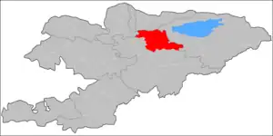 |
| Naryn District | Naryn | 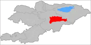 |
Naryn Region contains no cities of district significance and no urban-type settlements.[5]

Demographics
The population of Naryn Region, according to the Population and Housing Census of 2009 amounted to 245.3 thousand (enumerated de facto population) or 257.8 thousand (de jure population).[2] The region's population estimate for the beginning of 2021 was 292,140.[1]
| Year | Pop. | ±% p.a. |
|---|---|---|
| 1970 | 176,451 | — |
| 1979 | 214,459 | +2.19% |
| 1989 | 247,931 | +1.46% |
| 1999 | 249,115 | +0.05% |
| 2009 | 257,768 | +0.34% |
| 2021 | 292,140 | +1.05% |
| Note: resident population; Source:[2][1] | ||
Ethnic composition
According to the 2009 Census, the ethnic composition of the Naryn Region (de jure population) was:[2]
| Ethnic group | Population | Proportion of Naryn Region population |
|---|---|---|
| Kyrgyzs | 255,799 | 99.2% |
| Uzbeks | 568 | 0.2% |
| Dungans | 429 | 0.2% |
| Uygurs | 339 | 0.1% |
| Kazakhs | 215 | 0.1% |
| Russians | 157 | 0.1% |
| other groups | 261 | 0.1% |
Basic socio-economic indicators
The economically active population of Naryn Region in 2009 was 106,673, of which 96,862 employed and 9,811 (9.2%) unemployed.[2]
References
- 1 2 3 4 "Population of regions, districts, towns, urban-type settlements, rural communities and villages of Kyrgyz Republic" (XLS) (in Russian). National Statistics Committee of the Kyrgyz Republic. 2021. Archived from the original on 10 November 2021.
- 1 2 3 4 5 "2009 population and housing census of the Kyrgyz Republic: Naryn Region" (PDF) (in Russian). National Statistics Committee of the Kyrgyz Republic. 2010. pp. 12, 15, 39, 145.
- ↑ Sternberg, Troy (2020). "Conflict and contestation in Kyrgyz mining infrastructure". The Extractive Industries and Society. 7 (4): 1392–1400. doi:10.1016/j.exis.2020.10.016. S2CID 229423618.
- ↑ "Нарынская область - Регионы - О Кыргызстане - Добро пожаловать в Кыргызстан!". www.welcome.kg.
- 1 2 "Classification system of territorial units of the Kyrgyz Republic" (in Kyrgyz). National Statistics Committee of the Kyrgyz Republic. May 2021. pp. 32–39.
- 1 2 "National Committee on Statistics (in Kyrgyz/Russian)" (PDF). Archived from the original (PDF) on 22 July 2011.
- ↑ "National Committee on Statistics (in Kyrgyz/Russian)" (PDF). Archived from the original (PDF) on 22 July 2011.
Works cited
- Laurence Mitchell, Kyrgyzstan, Bradt Travel Guides, 2008
Places adjacent to Naryn Region | ||||||||||||||||
|---|---|---|---|---|---|---|---|---|---|---|---|---|---|---|---|---|
| ||||||||||||||||