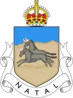
| Province of Natal | |||||||||
|---|---|---|---|---|---|---|---|---|---|
| Province of South Africa | |||||||||
| 1910–1994 | |||||||||
 Natal as it was by 1994 | |||||||||
| Capital | Pietermaritzburg | ||||||||
| Demonym | Natalian | ||||||||
| Area | |||||||||
| • Coordinates | 29°S 30°E / 29°S 30°E | ||||||||
| Population | |||||||||
• 1991 | 2,430,753[1] | ||||||||
| • Type | Natal Provincial Council | ||||||||
| History | |||||||||
• Established | 31 May 1910 | ||||||||
• Disestablished | 27 April 1994 | ||||||||
| |||||||||
The Province of Natal (Afrikaans: Natalprovinsie), commonly called Natal, was a province of South Africa from May 1910 until May 1994. Its capital was Pietermaritzburg. During this period rural areas inhabited by the black African population of Natal were organized into the bantustan of KwaZulu, which was progressively separated from the province, becoming partially autonomous in 1981. Of the white population, the majority were English-speaking people of British descent, causing Natal to become the only province to vote "No" to the creation of a republic in the referendum of 1960, due to very strong monarchist, pro-British Commonwealth, and anti-secessionist sentiment.[2] In the latter part of the 1980s, Natal was in a state of violence between the Inkatha Freedom Party and the African National Congress, with violence subsiding soon after the first non-racial election in 1994.[3][4]
In 1994, the KwaZulu bantustan was reincorporated into the territory of Natal and the province was redesignated as KwaZulu-Natal.
Districts in 1991

Districts of the province and population at the time of the 1991 census.[1]
- Mount Currie (main town Kokstad): 41,564
- Alfred (main town Harding): 8,794
- Port Shepstone: 67,239
- Umzinto: 46,919
- Ixopo: 22,626
- Polela: 4,364
- Underberg: 9,584
- Impendle: 2,815
- Richmond: 23,476
- Camperdown: 36,315
- Pietermaritzburg: 228,549
- Lions River: 43,060
- New Hanover: 38,207
- Mooirivier: 25,061
- Estcourt: 49,493
- Weenen: 12,485
- Bergville: 22,552
- Umvoti (main town Greytown): 41,160
- Kranskop: 7,565
- Durban: 473,826
- Inanda (main town Verulam): 299,379
- Pinetown: 184,216
- Chatsworth: 179,957
- Kliprivier: 64,782
- Glencoe: 17,265
- Dundee: 31,613
- Dannhauser: 14,154
- Newcastle: 53,584
- Utrecht: 27,798
- Paulpietersburg: 21,072
- Vryheid: 85,518
- Ngotshe: 26,382
- Lower Tugela (main town Stanger): 96,702
- Mtunzini: 18,455
- Eshowe: 13,355
- Mtonjaneni (main town Melmoth): 10,577
- Babanango: 3,069
- Lower Umfolozi (main town Empangeni): 56,082
- Hlabisa: 18,211
- Ubombo (main town Jozini): 2,929
Administrators
See also
- Coat of arms of Natal
- Mtetwa Empire (c. 1750–1817)
- Zululand (1816–1897)
- Natalia Republic (1839–1843)
- Colony of Natal (1843–1910)
- KwaZulu-Natal (1994–)
References
- 1 2 "Census > 1991 > RSA > Variable Description > Person file > District code". Statistics South Africa - Nesstar WebView. Archived from the original on 19 June 2016. Retrieved 18 August 2013.
- ↑ Ingalls, Leonard (11 May 1961). "Resentment Grows in Natal". The New York Times. Retrieved 2012-07-25.
- ↑ Wren, Christopher S. (19 October 1990). "De Klerk Lifts Emergency Rule in Natal Province". The New York Times. Retrieved 2012-07-25.
- ↑ Taylor, Rupert. "Justice denied: political violence in Kwazulu‐Natal after 1994." African Affairs 101, no. 405 (2002): 473-508.
External links
- Hillier, Alfred Peter; Cana, Frank Richardson (1911). . Encyclopædia Britannica. Vol. 19 (11th ed.). pp. 252–265.
- Cana, Frank Richardson (1922). . Encyclopædia Britannica. Vol. 31 (12th ed.). pp. 1058–1059.

.svg.png.webp)