Parkbeg, Saskatchewan | |
|---|---|
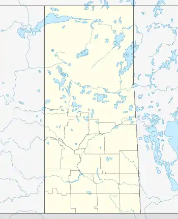
 Location of Parkbeg in Saskatchewan  Parkbeg (Canada) | |
| Coordinates: 50°27′00″N 106°16′00″W / 50.4500°N 106.2667°W | |
| Country | Canada |
| Province | Saskatchewan |
| Region | Saskatchewan |
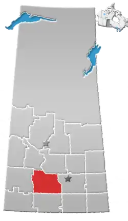
| Census division | 7 |
| Rural Municipality | Wheatlands |
| Post office Founded | 1911 |
| Incorporated (Village) | 1920 |
| Restructured (Hamlet) | December 31, 1957 |
| Government | |
| • Governing body | Wheatlands No. 163 |
| • Administrator | Elaine Salikin |
| • MP | Jeremy Patzer (Cypress Hills—Grasslands) |
| • MLA | Doug Steele (Cypress Hills) |
| Time zone | UTC−6 (CST) |
| Postal code | S0H 0E0 |
| Area code | 306 |
| Highways | Highway 1 Highway 627 |
| Railways | Canadian Pacific Railway |
| [1][2][3][4] | |
Parkbeg is a hamlet in Wheatlands Rural Municipality No. 163, Saskatchewan, Canada. The hamlet is located at the junction of Highway 1 and Highway 627 approximately 58 km directly west of the City of Moose Jaw on the Trans Canada Highway.
Demographics
Parkbeg, like so many other small communities throughout Saskatchewan, has struggled to maintain a sturdy population causing it to become a semi ghost town with only a few citizens. Prior to December 31, 1957, Parkbeg was incorporated under village status, but was restructured to hamlet status under the jurisdiction of the Rural municipality of Wheatlands on that date.[5]
Climate
| Climate data for Parkbeg | |||||||||||||
|---|---|---|---|---|---|---|---|---|---|---|---|---|---|
| Month | Jan | Feb | Mar | Apr | May | Jun | Jul | Aug | Sep | Oct | Nov | Dec | Year |
| Record high °C (°F) | 10 (50) |
17 (63) |
22.5 (72.5) |
30 (86) |
37.5 (99.5) |
42 (108) |
38.5 (101.3) |
38.5 (101.3) |
37.5 (99.5) |
31.5 (88.7) |
20 (68) |
15 (59) |
42 (108) |
| Mean daily maximum °C (°F) | −7.7 (18.1) |
−4.3 (24.3) |
2.1 (35.8) |
12.2 (54.0) |
19 (66) |
23.7 (74.7) |
26.4 (79.5) |
26.1 (79.0) |
19.2 (66.6) |
11.9 (53.4) |
0.2 (32.4) |
−6.1 (21.0) |
10.2 (50.4) |
| Daily mean °C (°F) | −13 (9) |
−9.2 (15.4) |
−3 (27) |
5.4 (41.7) |
12 (54) |
16.8 (62.2) |
19.2 (66.6) |
18.6 (65.5) |
12.3 (54.1) |
5.6 (42.1) |
−4.6 (23.7) |
−11.2 (11.8) |
4.1 (39.4) |
| Mean daily minimum °C (°F) | −18.2 (−0.8) |
−14.1 (6.6) |
−8 (18) |
−1.4 (29.5) |
4.9 (40.8) |
9.8 (49.6) |
12 (54) |
11.1 (52.0) |
5.4 (41.7) |
−0.9 (30.4) |
−9.5 (14.9) |
−16.3 (2.7) |
−2.1 (28.2) |
| Record low °C (°F) | −40 (−40) |
−39.5 (−39.1) |
−29.5 (−21.1) |
−23 (−9) |
−7.5 (18.5) |
−2 (28) |
2.5 (36.5) |
−1 (30) |
−6 (21) |
−21 (−6) |
−32.5 (−26.5) |
−42.5 (−44.5) |
−42.5 (−44.5) |
| Average precipitation mm (inches) | 10.1 (0.40) |
9.2 (0.36) |
17.8 (0.70) |
17.8 (0.70) |
48.1 (1.89) |
64.5 (2.54) |
65.3 (2.57) |
48 (1.9) |
38.6 (1.52) |
15.9 (0.63) |
13 (0.5) |
9.9 (0.39) |
358.4 (14.11) |
| Source: Environment Canada[6] | |||||||||||||
Services
Parkbeg has a café that also serves as a post office. There was also a grain elevator owned by Paterson Grain which was serviced by the Canadian Pacific Railway but which has now been demolished.[7]
Gainer the Gopher
Gainer the Gopher is the mascot of the Saskatchewan Roughriders, a Canadian Football League team. He is from Parkbeg.[8]
See also
References
- ↑ National Archives, Archivia Net, Post Offices and Postmasters, archived from the original on October 6, 2006
- ↑ Government of Saskatchewan, MRD Home, Municipal Directory System, archived from the original on January 15, 2016
- ↑ Canadian Textiles Institute. (2005), CTI Determine your provincial constituency, archived from the original on September 11, 2007
- ↑ Commissioner of Canada Elections, Chief Electoral Officer of Canada (2005), Elections Canada On-line, archived from the original on April 21, 2007, retrieved February 15, 2008
- ↑ Parkbeg Saskatchewan - Restructured Villages Archived 2008-03-25 at the Wayback Machine
- ↑ Environment Canada - Canadian Climate Normals 1971-2000—Canadian Climate Normals 1971–2000, accessed 10 December 2010
- ↑ "Parkbeg – Grain Elevators of Canada". Retrieved August 15, 2023.
- ↑ Saskatchewan Riderville - Gainer the Gopher Archived 2010-02-09 at the Wayback Machine
