Phaktanglung
फक्ताङलुङ | |
|---|---|
| फक्ताङलुङ | |
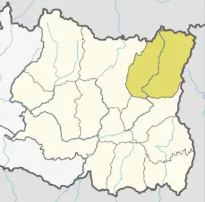
 Phaktanglung Location in Province 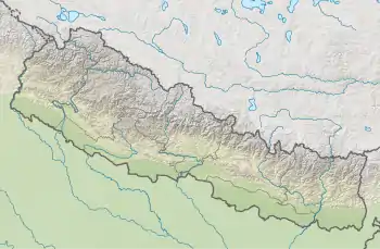 Phaktanglung Phaktanglung (Nepal) | |
| Coordinates: 27°26′59.99″N 87°44′24.12″E / 27.4499972°N 87.7400333°E | |
| Country | Nepal |
| Province | Province No. 1 |
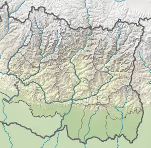
| District | Taplejung |
| No. of wards | 7 |
| Established | 10 March 2017 |
| Government | |
| • Type | Rural council |
| • Chairperson | Mr.Rajan Limbu "Mukti" (CPN (Maoist Centre) |
| • Vice-chairperson | Mr.Rabin Samra Limbu"Bikas" (NC) |
| Area | |
| • Total | 1,858.51 km2 (717.57 sq mi) |
| • Rank | 3rd largest (Nepal) 1st largest (Province No. 1) |
| Population (2017)[1] | |
| • Total | 12,017 |
| • Density | 6.5/km2 (17/sq mi) |
| Time zone | UTC+5:45 (NST) |
| Website | Official Website |
Phaktanglung is a Rural municipality (Gaunpalika) located in Taplejung District in Province No. 1 of eastern Nepal. The local body was formed by merging seven previous VDCs namely Sawadin, Khejenim, Linkhim, Ikhabu, Tapethok, Lelep, Olangchungkhola. Currently, it has a total of 7 wards. The population of the rural municipality is 12,017 according to the 2011 Nepal census and total area of the rural council is 1,858.51 square kilometres (717.57 sq mi) which is the 3rd largest rural council of Nepal. It is the 1st largest rural council of Province No. 1.
| # | Ward Name | Ward No. | Population (2011) | Area (KM²) |
|---|---|---|---|---|
| 1 | Sawadin | 1 | 1,461 | 11.07 |
| 2 | Khejenim | 2 | 2,406 | 29.75 |
| 3 | Linkhim | 3 | 2,214 | 26.33 |
| 4 | Ikhabu | 4 | 2,032 | 61.46 |
| 5 | Tapethok | 5 | 1,460 | 219.87 |
| 6 | Lelep | 6 | 2,205 | 808.53 |
| 7 | Olangchungola | 7 | 239 | 701.50 |
Geography
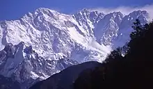
The whole rural municipality is a part of protected area which is called Kanchenjunga Conservation Area[2] comprises cultivated lands, forests, pastures, rivers, high altitude lakes and glaciers.
Constituencies
Phaktanglung RM falls under Taplejung 1 (parliamentary constituency) and Taplejung 1(B) (provincial) constituency.
Demography
The total population of Phaktanglung RM is 12,017 in which female comprises 6,137 and male comprises 5,880. There are 2,525 households in the RM.[3]
See also
References
- ↑ "MOFALD List of Gaupalika" (PDF). Retrieved 2017-06-02.
- ↑ "Kanchenjunga Conservation Area | Department of National Park and Wildlife Conservation". Archived from the original on 2021-01-07. Retrieved 2021-01-05.
- ↑ "NID | LocalBodies".