Pitt–Greenville Airport | |||||||||||||||
|---|---|---|---|---|---|---|---|---|---|---|---|---|---|---|---|
 | |||||||||||||||
| Summary | |||||||||||||||
| Airport type | Public | ||||||||||||||
| Owner | Pitt–Greenville Airport Authority | ||||||||||||||
| Operator | Pitt County & Greenville | ||||||||||||||
| Serves | Greenville, North Carolina | ||||||||||||||
| Elevation AMSL | 27 ft / 8.2 m | ||||||||||||||
| Coordinates | 35°38′07″N 77°23′07″W / 35.63528°N 77.38528°W | ||||||||||||||
| Website | flypgv.com | ||||||||||||||
| Maps | |||||||||||||||
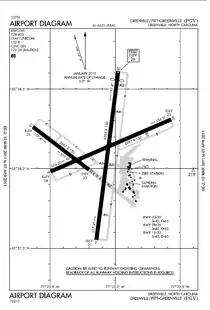
 Airport diagram showing the three runways | |||||||||||||||
 PGV  PGV | |||||||||||||||
| Runways | |||||||||||||||
| |||||||||||||||
Pitt–Greenville Airport (IATA: PGV, ICAO: KPGV, FAA LID: PGV) is a public airport located two miles (3 km) north of the central business district of Greenville, North Carolina, and East Carolina University. The airport covers 872 acres (353 ha) and has two runways.[1] It is mostly used for general aviation but is also served by American Airlines, which operates commuter service to Charlotte. The airport manager is Kim W. Hopper.
History
The Works Progress Administration constructed the Greenville Airport in 1940 on land that was jointly owned by the city of Greenville and Pitt County. A Civil Pilot Training Program operated from the airport until it was leased by the United States Navy on May 1, 1942, to be an outlying field of Marine Corps Air Station Cherry Point. The field was underutilized until November 30, 1942, when it was announced that it would be upgraded by the Civil Aeronautics Administration.[2]
The first Marine Corps flying squadrons to arrive were scout bombing squadrons VMSB-343 and VMSB-344 in January 1944. July saw the arrival of fighter squadrons VMF-913 and VMF-914 and October brought the photo reconnaissance squadrons VMD-354 and VMD-954. During the war, Outlying Field Greenville was the busiest of MCAS Cherry Point's outlying fields.[3] PGV used to service Delta Airlines to Atlanta
2011 Expansion
The airport officially opened the renovated air terminal on February 24, 2011. The $7.9 million expansion was funded by the federal stimulus. It took two years of planning and 18 months of construction.[4]
Runway expansion and safety improvements
The Airport Authority decided to extend Runway 2/20 by 670 feet. It will receive $2.5 million from the FAA to help buy out the affected houses. The groundbreaking occurred in August 2013, and was completed in 2014.[5][6] The lengthening will allow the current critical aircraft to operate at full payload service capabilities, including during hot weather.[7] For years, Pitt-Greenville had been hampered by its short runways. Teams playing games against East Carolina University had to fly into nearby Kinston because the runways were not long enough to handle modern charter jets.
This expansion will also bring this runway up to current runway safety area standards. Also included will be the clearing of tree obstacles and the installation of a new GPS RNAV vertically guided approach for Runway 2.[7]
Airline and destination
Passenger
| Airlines | Destinations |
|---|---|
| American Eagle | Charlotte[8] |
| Destination map |
|---|
Destination from Pitt-Greenville Airport |
Top destinations
| Rank | City | Passengers |
|---|---|---|
| 1 | Charlotte, North Carolina | 31,000 |
See also
References
- 1 2 FAA Airport Form 5010 for PGV PDF, effective June 21, 2018.
- ↑ Shettle(2001):40
- ↑ Shettle(2001):40–41
- ↑ Kennedy, Kathryn. "Airport Unveils $7.9 Million Expansion". The Daily Reflector. Archived from the original on 14 March 2012. Retrieved 10 March 2011.
- ↑ "Pitt–Greenville Airport Decides On Runway Extension Plans". WITN-TV. Retrieved 14 August 2012.
- ↑ "North Carolina airports receive $6(M) in grants". WBTV. 13 September 2012. Retrieved 16 November 2012.
- 1 2 Pitt–Greenville Airport Authority. "Notice Of Availability For Public Review And Comment – Draft Environmental Assessment For The Pitt–Greenville Airport Safety Improvements" (PDF). Pitt–Greenville Airport Authority. Retrieved 14 August 2012.
- ↑ "American Airlines Suspends Service to 15 Markets in October as CARES Act Service Commitment Expires". American Airlines Newsroom. Retrieved 20 August 2020.
- ↑ "RITA | BTS | Transtats". Bureau of Transportation Statistics. January 2017. Retrieved May 15, 2017.
Books
- Shettle Jr., M. L. (2001). United States Marine Corps Air Stations of World War II. Bowersville, Georgia: Schaertel Publishing Co. ISBN 0-9643388-2-3.
External links
- Pitt–Greenville Airport, official site
- "Pitt–Greenville Airport – PGV" (PDF). at North Carolina DOT airport guide
- FAA Airport Diagram (PDF), effective December 28, 2023
- FAA Terminal Procedures for PGV, effective December 28, 2023
- Resources for this airport:
- FAA airport information for PGV
- AirNav airport information for KPGV
- ASN accident history for PGV
- FlightAware airport information and live flight tracker
- NOAA/NWS weather observations: current, past three days
- SkyVector aeronautical chart, Terminal Procedures
