Puerto Plata | |
|---|---|
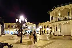 Puerto Plata, Dominican Republic downtown area. | |
 Flag  Coat of arms | |
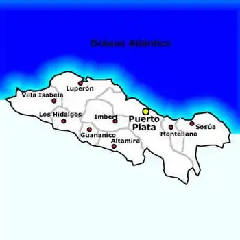
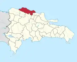 Location of the Puerto Plata Province | |
| Coordinates: 19°44′12″N 70°46′12″W / 19.73667°N 70.77000°W | |
| Country | |
| Province since | 1850 |
| Capital | San Felipe de Puerto Plata |
| Government | |
| • Type | Subdivisions |
| • Body | 9 municipalities 12 municipal districts |
| • Congresspersons | 1 Senator 6 Deputies |
| Area | |
| • Total | 1,852.90 km2 (715.41 sq mi) |
| Population (2014) | |
| • Total | 470,839 |
| • Density | 250/km2 (660/sq mi) |
| Time zone | UTC-4 (AST) |
| Area code | 1-809 1-829 1-849 |
| ISO 3166-2 | DO-18 |
| Postal Code | 57000 |
.jpg.webp)
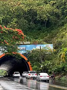
Puerto Plata (Spanish pronunciation: [pweɾtoˈplata], Silver Port) is one of the northern provinces of the Dominican Republic. The area has become an increasingly popular tourist attraction since the late 1990s mainly due to its fine beaches. It borders the Septentrional mountain range to the north (which separates it from Laguna Salada).
Created from the Santiago Province in 1867 as a "maritime district", it became a province in 1907, when maritime districts were suppressed by a new Dominican constitution.
History
In 1493, La Isabela was founded by Christopher Columbus, being the first European town in the Americas. For its part, Puerto Plata was founded by Nicolás de Ovando at the beginning of the Hispanic colonization, around 1502. One of the first inhabitants in the years 1509 of the "Villa de Puerto de Plata" was Gaspar Briceño, a native of Arévalo del Reino from Castilla y León, who arrived on the island as a servant of Juan de Berlanga, treasurer of the Mayor's Office of the city of Santo Domingo, on the island of Hispaniola. He held the position of "field bailiff" of the Villa de Santiago that belonged to the Villa de Concepción de la Vega and this corresponded to the Mayor's Office of the City of Santo Domingo. His name appears in the "Colón-Solís" trial, where the encomendero of the Villa de Santiago, Francisco de Solís, murdered two naborías Indians. The field bailiff was in charge of capturing the Indians or blacks who escaped from the parcels. It was one of the cities devastated in 1606 and was not repopulated until after 1736. The advent of republican times favored the development of the city, which over time became the main port of Cibao, especially for exporting the regional tobacco.[1]
By Resolution of the National Congress dated July 6, 1847, Puerto Plata was elevated from common to Maritime District. It became a province in the year 1850. In 1879 it was the seat of the government of Gregorio Luperón and served as the internal capital of the Republic.[2]
Municipalities and municipal districts

The province is divided into the following municipalities (municipios) and municipal districts (distrito municipal - D.M.) within them:[3]
- San Felipe de Puerto Plata
- Maimón (D.M.)
- Yásica Arriba (D.M.)
- Altamira
- Río Grande (D.M.)
- Guananico
- Imbert
- Los Hidalgos
- Cerro de Navas (D.M.)
- Luperón
- Los Bellosos (D.M.)
- La Isabela (D.M.)
- Los Conucos (D.M.)
- Sosúa
- Cabarete (D.M.)
- Sabaneta de Yásica (D.M.)
- Villa Isabela
- Estero Hondo (D.M.)
- La Jaiba (D.M.)
- Gualete (D.M.)
- Villa Montellano
The following is a sortable table of the municipalities with population figures as of the 2012 census (the last national census). Urban population are those living in the seats (cabeceras literally heads) of municipalities or of municipal districts. Rural population are those living in the districts (Secciones literally sections) and neighborhoods (Parajes literally places) outside of them.[4]
| Name | Total population | Urban population | Rural population |
|---|---|---|---|
| Altamira | 26,056 | 7,889 | 18,167 |
| Guananico | 8,954 | 3,025 | 5,929 |
| Imbert | 30,514 | 14,589 | 15,925 |
| Los Hidalgos | 14,589 | 3,022 | 11,567 |
| Luperón | 20,259 | 4,989 | 15,270 |
| San Felipe de Puerto Plata | 286,558 | 247,569 | 38,989 |
| Sosúa | 69,885 | 19,338 | 50,547 |
| Villa Isabela | 14,889 | 1,058 | 13,831 |
| Villa Montellano | 19,029 | 9,009 | 10,020 |
| Puerto Plata province | 490,733 | 310,488 | 180,245 |
For comparison with the municipalities and municipal districts of other provinces see the list of municipalities and municipal districts of the Dominican Republic.
Notable People
- Huascar Ynoa (b. 1998), pitcher for the Atlanta Braves
See also
References
- ↑ Manuel Gilbert. "Puerto Plata, su historia y riqueza" (in Spanish). Listin Diario.com. Archived from the original on 2011-07-04. Retrieved 9 February 2011.
- ↑ Ranter, Harro. "ASN Aircraft accident Boeing 757-225 TC-GEN Puerto Plata, Dominican Republic". aviation-safety.net. Aviation Safety Network. Retrieved 2021-01-26.
- ↑ Oficina Nacional de Estadistica, Departamento de Cartografia, Division de Limites y Linderos. "Listado de Codigos de Provincias, Municipio y Distritos Municipales, Actualizada a Junio 20 del 2006" (in Spanish). Archived from the original on 2007-03-14. Retrieved 2007-01-24.
{{cite web}}: CS1 maint: multiple names: authors list (link) - ↑ Consejo Nacional de Población y Familia. "Censos y Proyecciones de la Población Dominicana por Regiones, Provincias, Municipios y Distritos Municipales, 2012" (PDF) (in Spanish). Retrieved 2010-10-11.
External links
- (in Spanish) Oficina Nacional de Estadística, Statistics Portal of the Dominican Republic
- (in Spanish) Oficina Nacional de Estadística, Maps with administrative division of the provinces of the Dominican Republic, downloadable in PDF format