Route 198 | ||||
|---|---|---|---|---|
 | ||||
| Route information | ||||
| Maintained by Transports Québec | ||||
| Length | 140.5 km[1] (87.3 mi) | |||
| Major junctions | ||||
| West end | ||||
| East end | ||||
| Location | ||||
| Country | Canada | |||
| Province | Quebec | |||
| Major cities | Murdochville, Gaspé | |||
| Highway system | ||||
| ||||
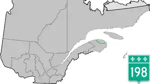
Route 198 is a 132 km two-lane highway which cuts through the Appalachian Mountains in the Gaspé Peninsula, Quebec, Canada. It acts both as a shortcut to get to Gaspé without having to go through many small villages and steep climbs on Route 132, and it also is the only link to Murdochville, the one municipality along this long stretch of highway. Route 198 starts at the junction of Route 132 in L'Anse-Pleureuse and ends again at the junction of Route 132 in Gaspé.
Municipalities along Route 198
.jpg.webp)
Route 198 Quebec
Major intersections
The entire route is in La Haute-Gaspésie RCM.
| Location | km[2] | mi | Destinations | Notes | |
|---|---|---|---|---|---|
| Saint-Maxime-du-Mont-Louis | 0.0 | 0.0 | |||
| Murdochville | 39.8 | 24.7 | |||
| Gaspé | 132.7 | 82.5 | West end of R-132 concurrency | ||
| 133.2 | 82.8 | East end of R-132 concurrency | |||
| 140.5 | 87.3 | ||||
1.000 mi = 1.609 km; 1.000 km = 0.621 mi
| |||||
See also
References
- ↑ Ministère des transports, "Distances routières", page 77, Les Publications du Québec, 2005
- ↑ Google (April 6, 2023). "Route 198 in Quebec" (Map). Google Maps. Google. Retrieved April 6, 2023.
External links
This article is issued from Wikipedia. The text is licensed under Creative Commons - Attribution - Sharealike. Additional terms may apply for the media files.
