| Romincka Forest | |
|---|---|
 Romincka Forest | |
| Map | |
 | |
| Geography | |
| Location | Poland, Russia |
| Coordinates | 54°22′18″N 22°31′17″E / 54.37167°N 22.52139°E |
| Area | 250 km2 (100 sq mi) |
Romincka Forest (Polish: Puszcza Romincka, Lithuanian: Romintos giria), also known as Krasny Les (Russian: Красный лес) or Rominte Heath (German: Rominter Heide), is an extended forest and heath landscape stretching from the southeast of Russian Kaliningrad Oblast to the northeast of Polish Warmian-Masurian Voivodeship.
Etymology
The Polish and German names of the forest, like the Rominta/Rominte river and the settlement of Rominty/Rominten, are derived from the Lithuanian syllable rom, meaning calm, as the forest is in the land called Lithuania Minor. The Russian name, Krasnyy Les, means "Red Forest".
Geography
The total area of the Romincka landscape is about 250 square kilometres (97 sq mi), stretching from the Masurian Lake District in the southwest up to the border with Lithuania at Lake Vištytis in the east. The southern Polish part (about one-third of the area) comprises a protected zone known as Puszcza Romincka Landscape Park.
The Krasnaya River flows through the Romincka Forest. Major settlements in the area include Krasnolesye in Kaliningrad Oblast, as well as Żytkiejmy and Gołdap in Poland.
Flora
The forest is part of the Central European mixed forests ecoregion. Trees in the Polish part of the forest are 40% spruce, 22% oak, 19% pine, 11% birch, 6% alder, and 2% linden and other species. Common plant communities include Tilio-Carpinetum forest on dry ground, composed of oak, spruce, linden, ash, alder, maple, elm, hornbeam, and birch. Undergrowth is generally sparse. Fraxino-Alnetum forest is found in marshy areas, with alder, spruce, linden, ash, and, less frequently, elm. Understory shrubs include bird cherry (Prunus padus), hazel, guelder rose, and saplings of canopy trees. Ground-elder (Aegopodium podagraria) and nettle (Urtica dioica) are common in the ground layer.[1]
History

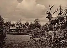
Part of the historic region of East Prussia, the extended forests were known for their red deer populations and became a popular hunting ground of the Hohenzollern princes who ruled the Duchy of Prussia from 1525. Part of the German Empire from 1871 onwards, a vast estate in Rominter Heide was purchased by Emperor Wilhelm II, who had his Rominten Hunting Lodge, including a chapel dedicated to Saint Hubertus, erected here in 1891. Hunt scenes were portrayed by notable painters such as Richard Friese (1854–1918).
Plundered by Russian forces in World War I, the hunting lodge and grounds were administered by the Free State of Prussia on Wilhelm's abdication in 1918; Minister-President Otto Braun was a regular guest. Later on, the estates were seized by Nazi minister Hermann Göring, whose Reichsjägerhof Rominten was built nearby in 1936. It also served as Göring's headquarters during the German Operation Barbarossa in 1941.
The Allied Potsdam Agreement after World War II divided the region between the re-established Polish Republic and the Soviet Union. The German history of the region is documented at the East Prussian Regional Museum in Lüneburg and at the German Hunting and Fishing Museum in Munich. In recent years, hunting tourism has again become popular.
References
- ↑ Marzec, M. (2010). Romincka forest – a malacofauna refuge of European significance. Folia Malacologica, 18(2), 71-82. https://doi.org/10.2478/v10125-010-0006-z Archived 2022-06-17 at the Wayback Machine.