 | ||||
|---|---|---|---|---|
| 国道338号 | ||||
Japan National Route 338 highlighted in red | ||||
 | ||||
| Route information | ||||
| Length | 241.3 km[1] (149.9 mi) | |||
| Existed | 1 April 1975–present | |||
| Major junctions | ||||
| North end | ||||
| South end | ||||
| Location | ||||
| Country | Japan | |||
| Highway system | ||||
| ||||
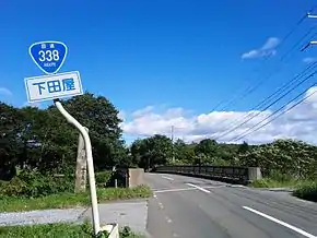
National Route 338 (国道338号, Kokudō San hyaku san jūhachigō) is a national highway in the Japanese prefectures of Hokkaido and Aomori. Route 338 stretches 241.3 kilometers (149.9 mi) from National Route 5 in Hakodate, Hokkaido south across the Tsugaru Strait by ferry to Ōma, Aomori, around the western, southern, and eastern edges of the Shimokita Peninsula and finally to Oirase.
Route description
Hakodate
National Route 338 begins at an intersection with National Route 5 in central Hakodate 150 meters (490 ft) east of Hakodate Station as part of an unsigned concurrency with National Route 279. The highway travels southwest along city streets through the city, then curves to the northwest, and turns northeast towards the former site of the city's ferry terminal, which was moved to the northwest of Hakodate Station. The highway's brief 1.8 kilometers (1.1 mi) route in Hokkaido ends at the former terminal, which has since been converted into a retail area.[2] Aside from the last 100 meters (330 ft) of the highway near the ferry terminal, the highway also carries the Main Line of the Hakodate City Tram in its median.[3]
Aomori Prefecture
The highway is next carried south across the Tsugaru Strait via the Tsugaru Kaikyō Ferry to Ōma on the northern tip of Aomori Prefecture's Shimokita Peninsula. From the route's northern terminus in Hakodate to Ōma, National Route 338 runs concurrent with National Route 279; however, in Ōma, National Route 279 leaves the concurrency, travelling southeast towards Mutsu while National Route 338 heads south towards the village of Sai. After passing through Sai, the highway enters the western edge of Mutsu and turns east towards the center of the city.
In Mutsu, national routes 279 and 338 briefly meet again, sharing a short concurrency. After leaving the concurrency, National Route 338 continues its path southeast across the peninsula while National Route 279 heads south towards Noheji at the southern base of the peninsula. National Route 338 parallels the Pacific coast for the rest of its route south through Higashidōri, Rokkasho, and Misawa before terminating in Oirase.[4]
History
National Route 338 was established by the Cabinet of Japan in 1975 between Hakodate and Oirase which was then the town of Shimoda, in Aomori.[5]
Major intersections
| Prefecture | Location | km | mi | Destinations | Notes | ||
|---|---|---|---|---|---|---|---|
| Hokkaido | Hakodate | 0.0 | 0.0 | Northern terminus; northern end of Route 279 concurrency | |||
| 1.2 | 0.75 | Hokkaido Route 675 (Tachimachi Misaki Hakodate Teishajō route) | |||||
| 1.7 | 1.1 | Hokkaido Route 457 (Hakodate Gyokō route) | |||||
| Tsugaru Strait | 1.8– 28.8 | 1.1– 17.9 | |||||
| Aomori | Ōma | 30.0 | 18.6 | Southern end of Route 279 concurrency | |||
| Sai | 42.3 | 26.3 | Aomori Route 284 | ||||
| 42.9 | 26.7 | Aomori Route 46 (Kamoshika Line) | |||||
| 44.0 | 27.3 | Aomori Route 46 south | |||||
| 77.5 | 48.2 | Aomori Route 253 east | |||||
| Mutsu | 102.1 | 63.4 | Aomori Route 175 west | ||||
| 120.4 | 74.8 | Aomori Route 46 north (Kamoshika Line) | |||||
| 140.1 | 87.1 | ||||||
| 142.8 | 88.7 | Aomori Route 272 | |||||
| 145.1 | 90.2 | Aomori Route 4 | |||||
| 145.3 | 90.3 | Northern end of Route 279 concurrency | |||||
| 146.0 | 90.7 | Southern end of Route 279 concurrency, northern end of unsigned Route 394 concurrency | |||||
| 147.6 | 91.7 | Mutsu-Higashidōri Interchange | |||||
| Higashidōri | 163.4 | 101.5 | Aomori Route 248 north | ||||
| 169.4 | 105.3 | Aomori Route 7 west | |||||
| Rokkasho | 183.7 | 114.1 | Aomori Route 179 west | ||||
| 193.9 | 120.5 | ||||||
| 197.5 | 122.7 | Aomori Route 24 west | |||||
| 199.4 | 123.9 | Aomori Route 180 west | |||||
| 203.2 | 126.3 | ||||||
| 208.7 | 129.7 | Southern end of unsigned Route 394 concurrency | |||||
| Misawa | 213.1 | 132.4 | Aomori Route 170 south | ||||
| 230.1 | 143.0 | Aomori Route 10 west | |||||
| 232.6 | 144.5 | Aomori Route 254 west | |||||
| Oirase | 236.9 | 147.2 | Aomori Route 19 south | ||||
| 241.3 | 149.9 | Southern terminus | |||||
1.000 mi = 1.609 km; 1.000 km = 0.621 mi
| |||||||
See also
References
- ↑ "一般国道の路線別、都道府県別道路現況" [Road statistics by General National Highway route and prefecture] (PDF) (in Japanese). Ministry of Land, Infrastructure, Transport and Tourism. Retrieved 18 February 2020.
- ↑ Google (11 October 2019). "Route 279 in Hakodate" (Map). Google Maps. Google. Retrieved 11 October 2019.
- ↑ "How to travel between Hakodate and Tokyo". japan-guide.com. Retrieved 11 October 2019.
- ↑ "国道338号線" (in Japanese). 26 September 2009. Retrieved 29 October 2019.
- ↑ "一般国道の路線を指定する政令" (in Japanese). Retrieved 10 October 2019 – via Wikisource.
External links
 Media related to Category:Route 338 (Japan) at Wikimedia Commons