Saint-Clet
Sant-Kleve | |
|---|---|
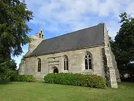 The chapel of Our Lady of Clérin | |
Location of Saint-Clet | |
 Saint-Clet  Saint-Clet | |
| Coordinates: 48°39′47″N 3°07′52″W / 48.6631°N 3.1311°W | |
| Country | France |
| Region | Brittany |
| Department | Côtes-d'Armor |
| Arrondissement | Guingamp |
| Canton | Bégard |
| Intercommunality | Guingamp-Paimpol Agglomération |
| Government | |
| • Mayor (2020–2026) | Claude Piriou[1] |
| Area 1 | 14.46 km2 (5.58 sq mi) |
| Population | 872 |
| • Density | 60/km2 (160/sq mi) |
| Time zone | UTC+01:00 (CET) |
| • Summer (DST) | UTC+02:00 (CEST) |
| INSEE/Postal code | 22283 /22260 |
| Elevation | 7–99 m (23–325 ft) |
| 1 French Land Register data, which excludes lakes, ponds, glaciers > 1 km2 (0.386 sq mi or 247 acres) and river estuaries. | |
Saint-Clet (French pronunciation: [sɛ̃ klɛt]; Breton: Sant-Kleve) is a commune in the Côtes-d'Armor department of Brittany in northwestern France.
Population
| Year | Pop. | ±% |
|---|---|---|
| 1962 | 814 | — |
| 1968 | 885 | +8.7% |
| 1975 | 861 | −2.7% |
| 1982 | 847 | −1.6% |
| 1990 | 744 | −12.2% |
| 1999 | 785 | +5.5% |
| 2008 | 845 | +7.6% |
Inhabitants of Saint-Clet are called saint-clétois in French.
See also
References
- ↑ "Répertoire national des élus: les maires". data.gouv.fr, Plateforme ouverte des données publiques françaises (in French). 9 August 2021.
- ↑ "Populations légales 2021". The National Institute of Statistics and Economic Studies. 28 December 2023.
External links
Wikimedia Commons has media related to Saint-Clet (Côtes-d'Armor).
- Base Mérimée: Search for heritage in the commune, Ministère français de la Culture. (in French)
This article is issued from Wikipedia. The text is licensed under Creative Commons - Attribution - Sharealike. Additional terms may apply for the media files.