Soraga di Fassa | |
|---|---|
| Comune di Soraga di Fassa | |
 | |
Location of Soraga di Fassa | |
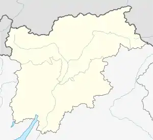
 Soraga di Fassa Location of Soraga di Fassa in Italy  Soraga di Fassa Soraga di Fassa (Trentino-Alto Adige/Südtirol) | |
| Coordinates: 46°24′N 11°40′E / 46.400°N 11.667°E | |
| Country | Italy |
| Region | Trentino-Alto Adige/Südtirol |
| Province | Trentino (TN) |
| Government | |
| • Mayor | Devi Brunel |
| Area | |
| • Total | 19.6 km2 (7.6 sq mi) |
| Elevation | 1,207 m (3,960 ft) |
| Population (28 February 2017)[2] | |
| • Total | 718 |
| • Density | 37/km2 (95/sq mi) |
| Demonym | Soragani or Soraghesi |
| Time zone | UTC+1 (CET) |
| • Summer (DST) | UTC+2 (CEST) |
| Postal code | 38030 |
| Dialing code | 0462 |
| Website | Official website |
Soraga di Fassa[3] (Ladin: Soraga or Soréga) is a comune (municipality) in Trentino in the northern Italian region Trentino-Alto Adige/Südtirol, located about 60 kilometres (37 mi) northeast of Trento. Soraga borders the following municipalities: Sèn Jan di Fassa, Falcade and Moena.
In the census of 2001, 574 inhabitants out of 673 (85.3%) declared Ladin as their native language.[4]
References
- ↑ "Superficie di Comuni Province e Regioni italiane al 9 ottobre 2011". Italian National Institute of Statistics. Retrieved 16 March 2019.
- ↑ All demographics and other statistics: Italian statistical institute Istat.
- ↑ "Comune di Soraga di Fassa – Comune di Soraga".
- ↑ "Tav. I.5 – Appartenenza alla popolazione di lingua ladina, mochena e cimbra, per comune di area di residenza (Censimento 2001)" (PDF). Annuario Statistico 2006 (in Italian). Autonomous Province of Trento. 2007. Retrieved 12 May 2011.
This article is issued from Wikipedia. The text is licensed under Creative Commons - Attribution - Sharealike. Additional terms may apply for the media files.
