North Tapanuli Regency
(Kabupaten Tapanuli Utara) | |
|---|---|
.jpg.webp) Welcome gate to North Tapanuli Regency in Siborongborong | |
 Seal | |
 | |
| Country | Indonesia |
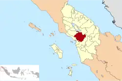
| Province | North Sumatra |
| Regency seat | Tarutung |
| Government | |
| • Regent | Nikson Nababan |
| • Vice Regent | Sarlandy Hutabarat |
| • Chairman of Regency's Council of Representatives | Poltak Pakpahan (PDI-P) |
| • Vice Chairpeople of Regency's Council of Representatives | Fatimah Hutabarat (Nasdem) and Reguel Simanjuntak (Golkar) |
| Area | |
| • Total | 3,793.71 km2 (1,464.76 sq mi) |
| Population (mid 2022 estimate)[1] | |
| • Total | 318,424 |
| • Density | 84/km2 (220/sq mi) |
| Time zone | UTC+7 (WIB) |
| Website | www |
North Tapanuli Regency (Tapanuli Utara - in Indonesian, "utara" means "north") is a landlocked regency in North Sumatra province, Sumatra, Indonesia. Its capital is Tarutung. The regency covers an area of 3,793.71 square kilometres and it had a population of 278,897 at the 2010 Census[2] and 312,758 at the 2020 Census;[3] the official estimate as at mid 2022 was 318,424.[1]
Administrative districts
The regency is divided into fifteen districts (kecamatan), tabulated below with their areas and their populations at the 2010 Census[2] and the 2020 Census,[3] together with the official estimates as at mid 2022.[1] The table also includes the locations of the district administrative centres, the number of administrative villages in each district (totalling 241 rural desa and 11 urban kelurahan) and its post code.
| Kode Wilayah | Name of District (kecamatan) | Area in km2 | Pop'n Census 2010 | Pop'n Census 2020 | Pop'n Estimate mid 2022 | Admin centre | No. of villages | Post code |
|---|---|---|---|---|---|---|---|---|
| 12.02.11 | Parmonangan | 257.35 | 13,021 | 14,578 | 14,737 | Manalu | 14 | 22453 |
| 12.02.03 | Adiankoting | 502.90 | 13,876 | 15,109 | 15,255 | Adiankoting | 16 | 22461 |
| 12.02.04 | Sipoholon | 189.20 | 22,265 | 24,156 | 24,618 | Sipoholon | 14 | 22452 |
| 12.02.01 | Tarutung | 107.68 | 39,500 | 42,831 | 43,694 | Tarutung | 31 (a) | 22411 -22417 (b) |
| 12.02.02 | Siatas Barita | 92.92 | 13,063 | 14,197 | 14,386 | Simorangkia | 12 | 22417 -22419 |
| 12.02.05 | Pahae Julu | 165.90 | 11,740 | 13,494 | 13,768 | Onan Hasang | 19 | 22463 |
| 12.02.06 | Pahae Jae | 203.20 | 10,569 | 12,092 | 12,326 | Pasar Sarulla | 13 | 22465 |
| 12.02.08 | Purbatua | 191.80 | 7,164 | 8,168 | 8,282 | Parsaoran Janji Angkola | 11 | 22464 |
| 12.02.07 | Simangumban | 150.00 | 7,300 | 8,369 | 8,482 | Aek Nabara | 8 | 22466 |
| 12.02.13 | Pangaribuan | 459.25 | 26,751 | 29,765 | 30,263 | Pakpahan | 26 | 22472 |
| 12.02.14 | Garoga | 567.58 | 15,581 | 18,214 | 18,530 | Garoga Sibargot | 13 | 22473 |
| 12.02.12 | Sipahutar | 408.22 | 24,536 | 27,828 | 28,319 | Siparhutar | 25 | 22471 |
| 12.02.09 | Siborongborong | 279.91 | 44,170 | 50,641 | 51,936 | Pasar Siborongborong | 21 | 22474 |
| 12.02.10 | Pagaran | 138.05 | 16,539 | 18,795 | 19,134 | Sipiltak | 14 | 22458 |
| 12.02.15 | Muara (c) | 79.75 | 13,182 | 14,521 | 14,694 | Hutana Nagodang | 15 | 22476 |
| Totals | 3,793.71 | 279.257 | 312,758 | 318,424 | Tarutung | 252 |
Note: (a) including 7 of the urban kelurahan of the district's 11 kelurahan. (b) except for the two desa of Jambur Nauli and Sihujur, which have the postcode of 22452.
(c) Muara District is a northern near-exclave of the regency, mainly situated on the southern shore of Lake Toba, and connected to Siborongborong District by a narrow strip of land.
It includes the island of Pulau Sibandang (12 km2 in area, with 2,357 inhabitants in 2020), which is situated in the lake.
Soda Pond

Soda Pond, or Aek Rara is located at the bottom of Parbubu I Hill village. The pond's natural spring water generates bubbles and a soda aroma can be smelled. It is safe for swimming, but the use of googles is recommended. The locals regularly use the water from the pond to water nearby rice paddy fields.[4]
References

2°00′10″N 99°04′15″E / 2.0028°N 99.0707°E