Teulada | |
|---|---|
| Comune di Teulada | |
 | |
 Coat of arms | |
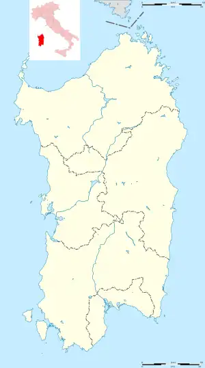
Location of Teulada | |
 Teulada Location of Teulada in Sardinia  Teulada Teulada (Sardinia) | |
| Coordinates: 38°58′N 8°46′E / 38.967°N 8.767°E | |
| Country | Italy |
| Region | Sardinia |
| Province | South Sardinia |
| Frazioni | Foxi, Genniomus, Gutturu Saidu, Is Carillus, Malfatano, Masoni de Monti, Masoni de Susu, Matteu, Perdaiola, Perdalonga, Sa Portedda, Su de Is Seis, Su Fonnesu |
| Government | |
| • Mayor | Angelo Milia[1] |
| Area | |
| • Total | 246.2 km2 (95.1 sq mi) |
| Elevation | 50 m (160 ft) |
| Population | |
| • Total | 3,591 |
| • Density | 15/km2 (38/sq mi) |
| Demonym | Teuladini (in Italian) or teuladesi (in Sardinian) |
| Time zone | UTC+1 (CET) |
| • Summer (DST) | UTC+2 (CEST) |
| Postal code | 09019 |
| Dialing code | 070 |
| Website | www.comune.teulada.ca.it/ |
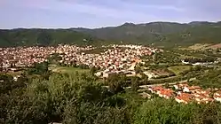
Teulada (Latin: Tegula[4]) is a comune (municipality) in the Province of South Sardinia in the Italian region Sardinia, located about 40 kilometres (25 mi) southwest of Cagliari.
The località of Sant'Isidoro di Teulada is one of the possible sites of the ancient Roman city of Bithia (also called Biotha and Biora).[5]

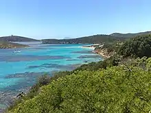
Tueredda beach
The Battle of Cape Spartivento was a short World War II naval battle on 27 November 1940 when HMS Newcastle and three other British cruisers engaged and exchanged fire with a number of ships of the Italian navy.
Twin towns
 Teulada, Spain
References
- ↑ https://comune.teulada.ca.it/web/it/amministrazione/sindaco
- ↑ All demographics and other statistics: Italian statistical institute Istat.
- ↑ "Popolazione Residente al 1° Gennaio 2018". Italian National Institute of Statistics. Retrieved 16 March 2019.
- ↑ Hazlitt's Classical Gazetteer, p. 338 Archived 2011-06-05 at the Wayback Machine
- ↑ Hazlitt's Classical Gazetteer, p.75 Archived 2011-06-05 at the Wayback Machine
External links
Wikimedia Commons has media related to Teulada (Italy).
This article is issued from Wikipedia. The text is licensed under Creative Commons - Attribution - Sharealike. Additional terms may apply for the media files.