Tirana District | |
|---|---|
 | |
| Coordinates: 41°18′N 19°53′E / 41.300°N 19.883°E | |
| Country | |
| Dissolved | 2000 |
| Seat | Tirana |
| Area | |
| • Total | 1,193 km2 (461 sq mi) |
| Population (2001) | |
| • Total | 523,150 |
| • Density | 440/km2 (1,100/sq mi) |
| Time zone | UTC+1 (CET) |
| • Summer (DST) | UTC+2 (CEST) |

Projected map of Tiranë District as defined by the Territorial-Administrative Reform of 2014
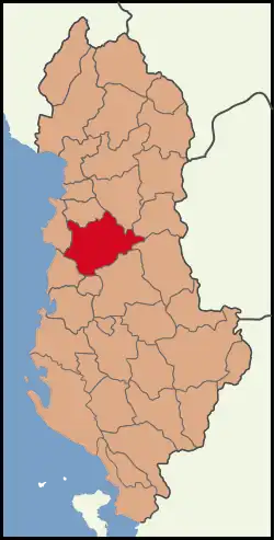
Tirana District (Albanian: Rrethi i Tiranës) was one of the 36 districts of Albania, which were dissolved in July 2000 and replaced by 12 newly created counties. It had a population of 523,150 in 2001, and an area of 1,193 km2 (461 sq mi).[1] Its territory is now part of Tirana County: the municipalities of Tirana, Kamëz and Vorë.
Administrative divisions
The district consisted of the following municipalities:[2]
See also
References
- ↑ Districts of Albania, statoids.com
- ↑ "Portraits of poverty and inequality in Albania" (PDF). World Bank Group. 2016. pp. 33–40.
External links
Districts in Albania were geographic divisions made up of cities, towns and villages. They were abolished in 2000. | |
| (36) | |
This article is issued from Wikipedia. The text is licensed under Creative Commons - Attribution - Sharealike. Additional terms may apply for the media files.