| Tulaczyk Glacier | |
|---|---|
 Location of Sentinel Range in Western Antarctica. | |
 Location of Thomson Glacier in Antarctica | |
| Location | Bryan Coast |
| Coordinates | 73°35′S 85°53′W / 73.583°S 85.883°W |
| Thickness | unknown |
| Status | unknown |

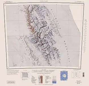
Central and southern Sentinel Range map.
Tulaczyk Glacier (78°35′S 85°53′W / 78.583°S 85.883°W) is a steep valley glacier draining the west slope of Vinson Massif southwest of Príncipe de Asturias Peak, and descending between Cairns Glacier and Zapol Glacier in the Sentinel Range, Antarctica. The glacier flows southwestward and leaving the range, together with Cairns Glacier joins Nimitz Glacier west of Hodges Knoll and southeast of Klenova Peak. It was named by US-ACAN (2006) after Slawek M. Tulaczyk, Earth Sciences, University of California, Santa Cruz; USAP researcher of West Antarctic ice streams from 1998.
See also
Maps
- Vinson Massif. Scale 1:250 000 topographic map. Reston, Virginia: US Geological Survey, 1988.
- Antarctic Digital Database (ADD). Scale 1:250000 topographic map of Antarctica. Scientific Committee on Antarctic Research (SCAR). Since 1993, regularly updated.
References
- Tulaczyk Glacier. SCAR Composite Antarctic Gazetteer.
 This article incorporates public domain material from "Tulaczyk Glacier". Geographic Names Information System. United States Geological Survey.
This article is issued from Wikipedia. The text is licensed under Creative Commons - Attribution - Sharealike. Additional terms may apply for the media files.