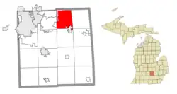
Williamstown Township, Michigan | |
|---|---|
 | |
 Williamstown Township Location within the state of Michigan  Williamstown Township Location within the United States | |
| Coordinates: 42°43′21″N 84°18′39″W / 42.72250°N 84.31083°W | |
| Country | United States |
| State | Michigan |
| County | Ingham |
| Organized | 1839 |
| Government | |
| • Supervisor | Wanda Bloomquist |
| • Clerk | Robin Cleveland |
| Area | |
| • Total | 29.26 sq mi (75.78 km2) |
| • Land | 29.09 sq mi (75.34 km2) |
| • Water | 0.17 sq mi (0.44 km2) |
| Elevation | 922 ft (281 m) |
| Population (2010) | |
| • Total | 4,978 |
| • Density | 171.7/sq mi (66.3/km2) |
| Time zone | UTC-5 (Eastern (EST)) |
| • Summer (DST) | UTC-4 (EDT) |
| FIPS code | 26-87440[1] |
| GNIS feature ID | 1627275[2] |
| Website | Official website |
Williamstown Township is a civil township of Ingham County in the U.S. state of Michigan. As of the 2010 census, the township population was 4,978.[3] The city of Williamston occupies the southeast corner of the township, but the two are administered autonomously.
Communities
- Africa was a section of Williamstown Township settled by the Webb family. They were vocal abolitionists, and other residents of the area called where they lived Africa.[4]
- Alverson was the name of a post office in Williamstown Township. Samuel Alverson was a large landowner, and he became the first postmaster with his home serving as the post office in September 1852. The office closed in October 1867 and reopened in June 1868 with William Alverson as postmaster. It closed again in November 1874 but was reopened again in December 1874 and operated until January 1896.[4]
- Haslett is an unincorporated community and census-designated place (CDP) with a small portion of the CDP extending east into township.
- Okemos is an unincorporated community and CDP with a small portion of the CDP extending east into the northern portion of the township.
Geography
According to the United States Census Bureau, the township has a total area of 29.26 square miles (75.78 km2), of which 29.09 square miles (75.34 km2) is land and 0.17 square miles (0.44 km2) (0.58%) is water.[3]
Demographics
As of the census[1] of 2000, there were 4,834 people, 1,692 households, and 1,416 families residing in the township. The population density was 164.3 inhabitants per square mile (63.4/km2). There were 1,732 housing units at an average density of 58.9 per square mile (22.7/km2). The racial makeup of the township was 97.56% White, 0.62% African American, 0.19% Native American, 0.56% Asian, 0.12% from other races, and 0.95% from two or more races. Hispanic or Latino of any race were 1.03% of the population.
There were 1,692 households, out of which 40.0% had children under the age of 18 living with them, 75.9% were married couples living together, 5.0% had a female householder with no husband present, and 16.3% were non-families. 12.9% of all households were made up of individuals, and 4.0% had someone living alone who was 65 years of age or older. The average household size was 2.85 and the average family size was 3.12.
In the township the population was spread out, with 28.9% under the age of 18, 4.6% from 18 to 24, 24.6% from 25 to 44, 32.7% from 45 to 64, and 9.1% who were 65 years of age or older. The median age was 41 years. For every 100 females, there were 100.6 males. For every 100 females age 18 and over, there were 100.3 males.
The median income for a household in the township was $79,778, and the median income for a family was $86,169. Males had a median income of $54,647 versus $38,854 for females. The per capita income for the township was $30,710. About 1.4% of families and 2.0% of the population were below the poverty line, including 1.8% of those under age 18 and 3.4% of those age 65 or over.
Education
The Williamston Community Schools serve most of Williamstown Township. However, portions of the township are also served by Haslett Public Schools in the northwest, Okemos Public Schools in the southwest, and Perry Public Schools in the northeast.
Highways
References
- 1 2 "U.S. Census website". United States Census Bureau. Retrieved January 31, 2008.
- ↑ U.S. Geological Survey Geographic Names Information System: Williamstown Township, Michigan
- 1 2 "Michigan: 2010 Population and Housing Unit Counts 2010 Census of Population and Housing" (PDF). 2010 United States Census. United States Census Bureau. September 2012. p. 25 Michigan. Archived (PDF) from the original on October 19, 2012. Retrieved January 14, 2021.
- 1 2 Romig 1986, p. 12.
Sources
- Romig, Walter (October 1, 1986) [1973]. Michigan Place Names: The History of the Founding and the Naming of More Than Five Thousand Past and Present Michigan Communities (Paperback). Detroit, Michigan: Wayne State University Press. ISBN 978-0814318386.
{{cite book}}:|work=ignored (help)
