Kostroma
Кострома | |
|---|---|
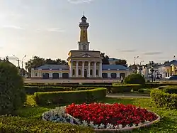
 Fire-observation watchtower in Kostroma (1825-1828) | |
.svg.png.webp) Flag  Coat of arms | |
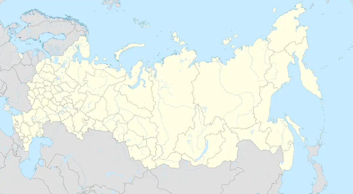
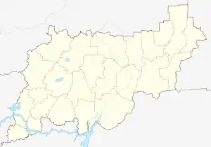
Location of Kostroma | |
 Kostroma Location of Kostroma  Kostroma Kostroma (Kostroma Oblast) | |
| Coordinates: 57°46′05″N 40°55′37″E / 57.76806°N 40.92694°E | |
| Country | Russia |
| Federal subject | Kostroma Oblast[1] |
| Founded | 1152[2] |
| Government | |
| • Head | Yuri Zhurin[3] |
| Elevation | 110 m (360 ft) |
| Population | |
| • Total | 268,742 |
| • Estimate (2018)[5] | 277,280 (+3.2%) |
| • Rank | 69th in 2010 |
| • Subordinated to | city of oblast significance of Kostroma[1] |
| • Capital of | Kostroma Oblast,[1] Kostromskoy District[1] |
| • Urban okrug | Kostroma Urban Okrug[6] |
| • Capital of | Kostroma Urban Okrug,[6] Kostromskoy Municipal District[6] |
| Time zone | UTC+3 (MSK |
| Postal code(s)[8] | 156XXX |
| Dialing code(s) | +7 4942 |
| OKTMO ID | 34701000001 |
| Website | grad |
Kostroma (Russian: Кострома́, IPA: [kəstrɐˈma]) is a historic city and the administrative center of Kostroma Oblast, Russia. A part of the Golden Ring of Russian cities, it is located at the confluence of the rivers Volga and Kostroma. Population: 267,481 (2021 Census);[9] 268,742 (2010 Census);[4] 278,750 (2002 Census);[10] 278,414 (1989 Census).[11]
History
Under the Rurikids
The official founding year of the city is 1152 by Yury Dolgoruky.[2] Since many scholars believe that early Eastern Slavs tribes arrived in modern-day Belarus, Ukraine and western Russia AD 400 to 600, Kostroma could be much older than previously thought.[12]
The city has the same name as the East Slavic goddess Kostroma.
Like other towns of the Eastern Rus, Kostroma was sacked by the Mongols in 1238. It then constituted a small principality, under leadership of Prince Vasily of Kostroma, a younger brother of the famous Alexander Nevsky. Upon inheriting the grand ducal title in 1271, Vasily didn't leave the town for Vladimir, and his descendants ruled Kostroma for another half a century, until the town was bought by Ivan I of Moscow.
.jpg.webp)
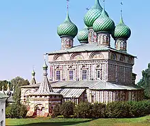
As one of the northernmost towns of the Grand Duchy of Moscow, Kostroma served for grand dukes as a place of retreat when enemies besieged Moscow in 1382, 1408, and 1433. In 1375, the town was looted by Novgorod pirates (ushkuiniks). The spectacular growth of the city in the 16th century may be attributed to the establishment of trade connections with English and Dutch merchants (Muscovy Company) through the northern port of Archangel. Boris Godunov had the Ipatiev[13] and Epiphany monasteries rebuilt in stone. The construction works were finished just in time for the city to witness some of the most dramatic events of the Time of Troubles.
The heroic peasant Ivan Susanin became a symbol of the city's resistance to foreign invaders; several monuments to him may be seen in Kostroma. The future Tsar, Mikhail Romanov, also lived at the monastery. It was here that an embassy from Moscow offered him the Russian crown in 1612.
Under the Romanovs
A wooden house of Mikhail Romanov is still preserved in the monastery. There are also several old wooden structures transported to the monastery walls from distant districts of the Kostroma Oblast.

In 1773, Kostroma was devastated by a great fire. Afterwards the city was rebuilt with streets radiating from a single focal point near the river. They say that Catherine the Great dropped her fan on the city map, and told the architects to follow her design. One of the best preserved examples of the 18th century town planning, Kostroma retains some elegant structures in a "provincial neoclassical" style. These include a governor's palace, a fire tower, a rotunda on the Volga embankment, and an arcaded central market with a merchant church in the center.
During and after the Russian Revolution
The First Workers' Socialist Club based in Kostroma was one of the best documented workers' clubs run by Proletkult. Organised around the principle of a "public hearth" (obshchestvennyi ochag) this club combined both practical support for workers in need of accommodation, food or furniture, as well as providing a focus for popular education.
Recent history
The Nuclear Power Referendum was arranged in 1990 in the Kostroma area. 90% of the voting population were against nuclear power in the area.[14]
The Kostroma Nuclear Power Plant article goes into more detail about the history of nuclear power, in Kostroma.
Administrative and municipal status

Kostroma is the administrative center of the oblast and, within the framework of administrative divisions, it also serves as the administrative center of Kostromskoy District,[1] even though it is not a part of it.[15] As an administrative division, it is incorporated separately as the city of oblast significance of Kostroma—an administrative unit with a status equal to that of the districts.[1] As a municipal division, the city of oblast significance of Kostroma is incorporated as Kostroma Urban Okrug.[6]
Geography
The city is located at the confluence of the rivers Volga and Kostroma.
Climate
Kostroma has a continental climate (Köppen Dfb). It has long, very cold winters and short warm summers.
| Climate data for Kostroma (1991–2020, extremes 1842–present) | |||||||||||||
|---|---|---|---|---|---|---|---|---|---|---|---|---|---|
| Month | Jan | Feb | Mar | Apr | May | Jun | Jul | Aug | Sep | Oct | Nov | Dec | Year |
| Record high °C (°F) | 6.6 (43.9) |
7.2 (45.0) |
17.9 (64.2) |
27.6 (81.7) |
32.5 (90.5) |
34.5 (94.1) |
37.1 (98.8) |
37.3 (99.1) |
30.2 (86.4) |
22.9 (73.2) |
13.8 (56.8) |
9.4 (48.9) |
37.3 (99.1) |
| Mean daily maximum °C (°F) | −5.9 (21.4) |
−4.8 (23.4) |
1.0 (33.8) |
10.2 (50.4) |
18.2 (64.8) |
21.7 (71.1) |
24.2 (75.6) |
21.7 (71.1) |
15.6 (60.1) |
7.7 (45.9) |
0.0 (32.0) |
−4.0 (24.8) |
8.8 (47.9) |
| Daily mean °C (°F) | −8.8 (16.2) |
−8.2 (17.2) |
−2.8 (27.0) |
5.0 (41.0) |
12.3 (54.1) |
16.1 (61.0) |
18.6 (65.5) |
16.3 (61.3) |
10.9 (51.6) |
4.4 (39.9) |
−2.3 (27.9) |
−6.6 (20.1) |
4.6 (40.2) |
| Mean daily minimum °C (°F) | −11.8 (10.8) |
−11.3 (11.7) |
−6.3 (20.7) |
0.8 (33.4) |
7.1 (44.8) |
11.1 (52.0) |
13.7 (56.7) |
11.7 (53.1) |
7.2 (45.0) |
1.8 (35.2) |
−4.4 (24.1) |
−9.1 (15.6) |
0.9 (33.6) |
| Record low °C (°F) | −46.4 (−51.5) |
−39.3 (−38.7) |
−31.1 (−24.0) |
−19.0 (−2.2) |
−5.5 (22.1) |
−2.7 (27.1) |
3.2 (37.8) |
1.3 (34.3) |
−5.8 (21.6) |
−21.1 (−6.0) |
−28.8 (−19.8) |
−44.4 (−47.9) |
−46.4 (−51.5) |
| Average precipitation mm (inches) | 41 (1.6) |
29 (1.1) |
31 (1.2) |
35 (1.4) |
53 (2.1) |
74 (2.9) |
73 (2.9) |
73 (2.9) |
56 (2.2) |
64 (2.5) |
49 (1.9) |
40 (1.6) |
618 (24.3) |
| Average extreme snow depth cm (inches) | 35 (14) |
44 (17) |
43 (17) |
10 (3.9) |
0 (0) |
0 (0) |
0 (0) |
0 (0) |
0 (0) |
1 (0.4) |
5 (2.0) |
18 (7.1) |
44 (17) |
| Average rainy days | 6 | 5 | 8 | 14 | 16 | 17 | 16 | 17 | 18 | 18 | 11 | 8 | 154 |
| Average snowy days | 28 | 24 | 18 | 8 | 1 | 0.1 | 0 | 0 | 1 | 7 | 20 | 27 | 134 |
| Average relative humidity (%) | 87 | 83 | 77 | 68 | 64 | 72 | 74 | 78 | 82 | 86 | 88 | 88 | 79 |
| Mean monthly sunshine hours | 35.1 | 68.7 | 136.9 | 193.0 | 257.1 | 278.6 | 284.3 | 232.4 | 136.5 | 67.6 | 29.7 | 22.2 | 1,742.1 |
| Source 1: Pogoda.ru.net[16] | |||||||||||||
| Source 2: NOAA[17] | |||||||||||||
| Year | Pop. | ±% |
|---|---|---|
| 1897 | 41,336 | — |
| 1926 | 72,317 | +74.9% |
| 1939 | 121,325 | +67.8% |
| 1959 | 171,720 | +41.5% |
| 1970 | 223,042 | +29.9% |
| 1979 | 254,725 | +14.2% |
| 1989 | 278,414 | +9.3% |
| 2002 | 278,750 | +0.1% |
| 2010 | 268,742 | −3.6% |
| 2021 | 267,481 | −0.5% |
| Source: Census data | ||
Sights and landmarks


Built in 1559-1565, the five-domed Epiphany Cathedral was the first stone edifice in the city; its medieval frescoes perished during a fire several years ago. The minster houses the city's most precious relic, a 10th-century Byzantine icon called Our Lady of St. Theodore. It was with this icon that Mikhail Romanov was blessed by his mother when he left for Moscow to claim the Russian throne. They say that just before the Revolution of 1917, the icon blackened so badly that the image was hardly visible; it was interpreted as a bad sign for the Romanov dynasty.
The Ipatyevsky monastery survives mostly intact, with its 16th-century walls, towers, belfry, and the 17th-century cathedral.
Apart from the monasteries, most of the city churches were either rebuilt or demolished during the Soviet years. The only city church that survives from the 17th-century "golden age" is the Resurrection church on the Lowlands (Russian: церковь Воскресения на Дебре). As the story goes, the church was commissioned by one merchant who ordered in England ten barrels of dye but received ten barrels of gold instead. He resolved that the unearned gold was the devil's gift and decided to spend it on building a church. Two other 17th-century temples, of rather conventional architecture, may be seen on the opposite side of the Volga.
Among the vestiges of the Godunov rule, a fine tent-like church in the urban-type settlement of Krasnoye-na-Volge (formerly an estate of Boris Godunov's brother) may be recommended.
Transportation
The city is served by the Kostroma Airport. Since 1887 there has been a railway connection between Kostroma and Moscow.[18]
Notable people
- Olesya Barel (born 1960), basketball player
- Nina Demme (1902–1977), polar explorer and biologist
- Aleksandra Ishimova (1805–1881), translator and author of children's books
- Roman Kopin (born 1974), Governor of Chukotka Autonomous Okrug
- Aleksey Pisemsky (1821–1881), novelist and dramatist
- The Lubavitcher Rebbe, Rabbi Yosef Yitzchak Shneersohn was exiled to Kostroma by the USSR in 1927 for 3 years, and was released after 9 days
Twin towns – sister cities
Following the 2022 Russian invasion of Ukraine, Durham County council revoked the twinning arrangements with Kostroma, which had been in place since 1968.[20][21]
References
Notes
- 1 2 3 4 5 6 7 Law #112-4-ZKO
- 1 2 Official website of Kostroma. Kostroma Today
- ↑ Official website of Kostroma. Viktor Valentinovich Yemets, Head of the Kostroma City Administration
- 1 2 Russian Federal State Statistics Service (2011). Всероссийская перепись населения 2010 года. Том 1 [2010 All-Russian Population Census, vol. 1]. Всероссийская перепись населения 2010 года [2010 All-Russia Population Census] (in Russian). Federal State Statistics Service.
- ↑ "26. Численность постоянного населения Российской Федерации по муниципальным образованиям на 1 января 2018 года". Federal State Statistics Service. Retrieved January 23, 2019.
- 1 2 3 4 Law #237-ZKO
- ↑ "Об исчислении времени". Официальный интернет-портал правовой информации (in Russian). June 3, 2011. Retrieved January 19, 2019.
- ↑ Почта России. Информационно-вычислительный центр ОАСУ РПО. (Russian Post). Поиск объектов почтовой связи (Postal Objects Search) (in Russian)
- ↑ Russian Federal State Statistics Service. Всероссийская перепись населения 2020 года. Том 1 [2020 All-Russian Population Census, vol. 1] (XLS) (in Russian). Federal State Statistics Service.
- ↑ Russian Federal State Statistics Service (May 21, 2004). Численность населения России, субъектов Российской Федерации в составе федеральных округов, районов, городских поселений, сельских населённых пунктов – районных центров и сельских населённых пунктов с населением 3 тысячи и более человек [Population of Russia, Its Federal Districts, Federal Subjects, Districts, Urban Localities, Rural Localities—Administrative Centers, and Rural Localities with Population of Over 3,000] (XLS). Всероссийская перепись населения 2002 года [All-Russia Population Census of 2002] (in Russian).
- ↑ Всесоюзная перепись населения 1989 г. Численность наличного населения союзных и автономных республик, автономных областей и округов, краёв, областей, районов, городских поселений и сёл-райцентров [All Union Population Census of 1989: Present Population of Union and Autonomous Republics, Autonomous Oblasts and Okrugs, Krais, Oblasts, Districts, Urban Settlements, and Villages Serving as District Administrative Centers]. Всесоюзная перепись населения 1989 года [All-Union Population Census of 1989] (in Russian). Институт демографии Национального исследовательского университета: Высшая школа экономики [Institute of Demography at the National Research University: Higher School of Economics]. 1989 – via Demoscope Weekly.
- ↑ "Early East Slavic Tribes in Russia | Study.com". Study.com. Retrieved September 13, 2018.
- ↑ Local History website. K. Torop. Kostroma
- ↑ Teoksessa Venäjän ihmisoikeusliike Gaudeamus Helsinki 2007
- ↑ Resolution #133-a
- ↑ "Погода и Климат – Климат Кострома" (in Russian). Weather and Climate (Погода и климат). Retrieved November 13, 2021.
- ↑ "Kostroma Climate Normals 1991–2020". National Oceanic and Atmospheric Administration. Retrieved November 13, 2021.
- ↑ "Train Station in Kostroma" (in Russian). Archived from the original on March 23, 2012. Retrieved December 2, 2012.
- ↑ "Международное и межмуниципальное сотрудничество". duma-kostroma.ru (in Russian). Duma Kostroma. Retrieved February 1, 2020.
- ↑ "Ukraine: County Durham ends twinning links with Russian city Kostroma". BBC News. September 6, 2021. Retrieved March 16, 2022.
- ↑ "Durham City Council votes to suspend ties with Russian sister city". The Chronicle. Retrieved September 7, 2022.
Sources
- Костромская областная Дума. Закон №112-4-ЗКО от 9 февраля 2007 г. «Об административно-территориальном устройстве Костромской области», в ред. Закона №567-5-ЗКО от 24 сентября 2014 г. «О внесении изменений в Закон Костромской области "Об административно-территориальном устройстве Костромской области"». Вступил в силу со дня официального опубликования. Опубликован: "СП — нормативные документы", №10(70), 28 февраля 2007 г. (Kostroma Oblast Duma. Law #112-4-ZKO of February 9, 2007 On the Administrative-Territorial Structure of Kostroma Oblast, as amended by the Law #567-5-ZKO of September 24, 2014 On Amending the Law of Kostroma Oblast "On the Administrative-Territorial Structure of Kostroma Oblast". Effective as of the official publication date.).
- Администрация Костромской области. Постановление №133-а от 8 апреля 2014 г. «Об утверждении реестра населённых пунктов Костромской области». Вступил в силу 11 апреля 2014 г. Опубликован: "СП — нормативные документы", №15, 11 апреля 2014 г. (Administration of Kostroma Oblast. Resolution #133-a of April 8, 2014 On the Adoption of the Registry of the Inhabited Localities of Kostroma Oblast. Effective as of April 11, 2014.).
- Костромская областная Дума. Закон №237-ЗКО от 30 декабря 2004 г. «Об установлении границ муниципальных образований в Костромской области и наделении их статусом», в ред. Закона №496-5-ЗКО от 28 февраля 2014 г. «О внесении изменений в Закон Костромской области "Об установлении границ муниципальных образований в Костромской области и наделении их статусом"». Вступил в силу по истечении 10 дней со дня официального опубликования. Опубликован: "Северная Правда" ("Документы: СпецВыпуск"), №8, 26 января 2005 г. (Kostroma Oblast Duma. Law #237-ZKO of December 30, 2004 On the Establishment of the Borders of the Municipal Formations and on Granting Them Statuses, as amended by the Law #496-5-ZKO of February 28, 2014 On Amending the Law of Kostroma Oblast "On the Establishment of the Borders of the Municipal Formations and on Granting Them Statuses". Effective as of after 10 days following the official publication date.).
External links
- Official website of Kostroma (in Russian)