| Zurn Peak | |
|---|---|
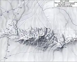 Aerial view of Toney Mountain with Zurn Peak in the upper center | |
| Highest point | |
| Elevation | 1,515 m (4,970 ft) |
| Listing | Ultra |
| Coordinates | 75°44′S 115°40′W / 75.733°S 115.667°W |
| Geography | |
| Location | Marie Byrd Land, Antarctica |
Zurn Peak (75°44′S 115°40′W / 75.733°S 115.667°W) is a rocky peak (1,515 m) rising from the north edge of Toney Mountain, about 4 miles (6 km) northeast of Richmond Peak and just east of Roberts Cirque, in Marie Byrd Land.
Mapped by United States Geological Survey (USGS) from surveys and U.S. Navy air photos, 1959–71, it was named by the Advisory Committee on Antarctic Names (US-ACAN) for Walter Zürn, Station Scientific Leader at South Pole Station, in 1972.
![]() This article incorporates public domain material from "Zurn Peak". Geographic Names Information System. United States Geological Survey.
This article incorporates public domain material from "Zurn Peak". Geographic Names Information System. United States Geological Survey.
This article is issued from Wikipedia. The text is licensed under Creative Commons - Attribution - Sharealike. Additional terms may apply for the media files.