 | |
| Local date | November 25, 1667 |
|---|---|
| Magnitude | 6.9 Ms |
| Depth | 12 km |
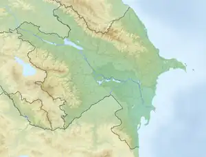
| Epicenter | 40°36′N 48°36′E / 40.6°N 48.6°E[1] |
| Areas affected | Shamakhi, Shirvan, Safavid Iran (present-day Azerbaijan Republic) |
| Max. intensity | X (Extreme) |
| Casualties | 80,000 |
The 1667 Shamakhi earthquake occurred on 25 November 1667 with an epicenter close to the city of Shamakhi, Azerbaijan (then part of Safavid Iran).[2] It had an estimated surface wave magnitude of 6.9 and a maximum felt intensity of X (Extreme) on the Mercalli intensity scale. An estimated 80,000 people died.[1]
See also
References
- 1 2 National Geophysical Data Center / World Data Service (NGDC/WDS): NCEI/WDS Global Significant Earthquake Database. NOAA National Centers for Environmental Information. "Significant Earthquake Information". doi:10.7289/V5TD9V7K. Retrieved 30 March 2022.
- ↑ Matthee, Rudi (2012). Persia in Crisis: Safavid Decline and the Fall of Isfahan. I.B.Tauris. p. 153. ISBN 978-1-84511-745-0.
This article is issued from Wikipedia. The text is licensed under Creative Commons - Attribution - Sharealike. Additional terms may apply for the media files.