 | |
| UTC time | 2010-04-18 20:28:50 |
|---|---|
| ISC event | 14580687 |
| USGS-ANSS | ComCat |
| Local date | 18 April 2010 |
| Local time | 20:28:50 UTC [1] |
| Magnitude | 5.6 Mwc[2] |
| Depth | 13 km (8.1 mi) [2] |
| Epicenter | 35°43′N 67°41′E / 35.71°N 67.68°E [1] |
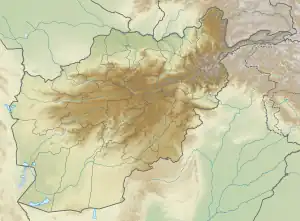
| Areas affected | Afghanistan |
| Max. intensity | VII (Very strong)[3] |
| Landslides | Yes [4] |
| Casualties | 11 killed, 70+ injured [4] |
The 2010 Afghanistan earthquake occurred on April 18 with a moment magnitude of 5.6. The earthquake could be felt in Mazar-i-Sharif, Kabul, and elsewhere in Afghanistan, as well as in Uzbekistan and Tajikistan.[4] Eleven people were killed and more than 70 were injured. More than 2,000 houses were destroyed.
References
- 1 2 ISC (19 January 2015), ISC-GEM Global Instrumental Earthquake Catalogue (1900–2009), Version 2.0, International Seismological Centre
- 1 2 ANSS: Afghanistan 2010 .
- ↑ National Earthquake Information Center (18 April 2010). "PAGER". United States Geological Survey. Archived from the original on 23 April 2010. Retrieved 9 April 2023.
- 1 2 3 ANSS. "Afghanistan 2010: M 5.6 – central Afghanistan". Comprehensive Catalog. U.S. Geological Survey.
External links
- The International Seismological Centre has a bibliography and/or authoritative data for this event.
This article is issued from Wikipedia. The text is licensed under Creative Commons - Attribution - Sharealike. Additional terms may apply for the media files.