| 2020 Colorado wildfires | |
|---|---|
 | |
| Statistics[1] | |
| Total fires | 1,078 |
| Total area | 665,454 acres (269,300 ha) |
| Cost | >$266 million (suppression)[2] |
| Deaths | 2[3] |
| Season | |
← 2019
2021 → | |
| 2020 Western U.S. wildfires |
|---|
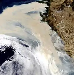 |
The 2020 Colorado wildfire season was a series of significant wildfires that burned throughout the U.S. state of Colorado as part of the 2020 Western United States wildfire season. With a total of 665,454 acres (269,300 ha) burned, and the 3 largest fires in state history, it is Colorado's largest wildfire season on record.[4]
During this season, the Cameron Peak Fire burned 208,913 acres, making it the largest wildfire recorded in the state of Colorado after it surpassed the Pine Gulch Fire, which earned the title seven weeks prior.[5][6] Also surpassing the Pine Gulch Fire in size was the East Troublesome Fire, which, when fully contained on November 30, had burned a total of 193,812 acres. In total, the suppression costs for the fires during the 2020 season amounted to at least $266 million (2020 USD). Throughout the year thousands of people were forced to evacuate, including the whole town of Estes Park during the East Troublesome fire. Air quality was poor as well through much of the fire season, especially during the Cameron Peak and East Troublesome fires. [2]
List of wildfires
The following is a list of fires that burned more than 1,000 acres (400 ha), or produced significant structural damage or casualties.
| Name | County | Acres | Start date | Containment date | Notes | Ref |
|---|---|---|---|---|---|---|
| Bent Fort | Otero | 1,500 | April 11 | April 13 | Human-caused. | [2][7] |
| PCMS Complex | Las Animas | 2,175 | May 16 | May 21 | Unknown cause. | [2][8] |
| Villegreen | Las Animas | 1,731 | May 18 | May 18 | Human-caused. | [2][9] |
| Cherry Canyon | Las Animas | 11,818 | May 20 | May 27 | Caused by lightning. | [2][10] |
| Bent Canyon | Las Animas | 1,800 | June 4 | June 11 | Caused by lightning. | [2][11] |
| Barela | Las Animas | 2,521 | June 5 | June 5 | Caused by lightning. | [2][12] |
| Sieber | Mesa | 1,094 | June 5 | June 9 | Unknown cause. | [2][13] |
| Deer Canyon | Las Animas | 3,872 | June 6 | June 20 | Caused by lightning. | [2][14] |
| Fawn Creek | Rio Blanco | 3,226 | July 13 | July 23 | Caused by lightning. | [2][15] |
| East Canyon | La Plata, Montezuma | 2,905 | June 14 | June 27 | Caused by lightning. | [2][16] |
| County Road T | Kiowa | 1,201 | June 15 | June 16 | Human-caused. | [2][17] |
| Prowers | Prowers | 1,472 | June 17 | June 17 | Human-caused. | [2][18] |
| Streeter | Moffat | 1,639 | July 7 | July 27 | Human-caused. | [2][19] |
| Sunday | Weld | 2,000 | July 19 | July 19 | Unknown cause. | [2] |
| Pine Gulch | Mesa, Garfield | 139,007 | July 31 | September 22 | Caused by lightning. It was the largest wildfire in Colorado history until it was surpassed by the Cameron Peak Fire seven weeks later. 6 structures destroyed | [2][6] |
| Grizzly Creek | Garfield, Eagle | 32,631 | August 10 | December 18 | Human-caused. 3 structures destroyed. | [2][20] |
| Cameron Peak | Larimer | 208,913 | August 13 | December 2 | Unknown cause. It is the largest wildfire in Colorado history. 469 structures destroyed, 8 structures damaged. | [2][21][22] |
| Williams Fork | Grand | 14,833 | August 14 | November 15 | Human-caused. | [2][23] |
| Deter-Winters | Adams | 2,000 | August 19 | August 19 | Unknown cause. | [2][24] |
| Shamrock | Adams | 4,200 | August 19 | August 19 | Unknown cause. | [2][25] |
| East Fork | Las Animas | 1,682 | August 22 | September 24 | Caused by lightning. Burned in two state wildlife areas. | [2][26] |
| Middle Fork | Routt, Jackson | 20,517 | September 6 | November 17 | Caused by lightning. | [2][27] |
| Mullen | Jackson, Carbon (WY), Albany (WY) | 176,878 | September 17 | December 3 | Unknown cause. The fire started in Wyoming, and crossed into Colorado on September 30. Sixty-six structures destroyed. | [2][28][29] |
| East Troublesome | Grand, Larimer | 193,812 | October 14 | November 30 | Unknown cause, 580 structures destroyed, 2 fatalities.[3] As it underwent an explosive burst of growth on October 21, the fire created a huge pyrocumulonimbus cloud that rose to about 40,000 ft (12,000 m).[30] | [2][31] |
| Calwood | Boulder | 10,106 | October 17 | November 19 | Unknown cause, 28 structures destroyed. | [2][32] |
| As of October 1, 2023 (UTC) | ||||||
See also
References
- ↑ "National Year-to-Date Report on Fires and Acres Burned" (PDF). Retrieved December 16, 2020.
*This resource is annually updated, therefore its data doesn't represent this article's fires. For the archived PDF, see National Year-to-Date Report on Fires and Acres Burned by State and Agency for 2020. - 1 2 3 4 5 6 7 8 9 10 11 12 13 14 15 16 17 18 19 20 21 22 23 24 25 26 27 "National Large Incident Year-to-Date Report" (PDF). Retrieved December 16, 2020.
*This resource is annually updated, therefore its data doesn't represent this article's fires. For the archived PDF, see National Large Incident Year-to-Date Report for 2020. - 1 2 Spells, Alta; Maxouris, Christina (October 24, 2020). "An elderly couple refused to leave the home they loved and were killed in the East Troublesome Fire". CNN. Retrieved October 24, 2020.
- ↑ Ingold, John (October 20, 2020). "Five charts that show where 2020 ranks in Colorado wildfire history". Colorado Sun. Retrieved June 27, 2021.
- ↑ Lytle, Kevin. "Cameron Peak Fire becomes largest wildfire in Colorado history, growing more than 20,000 acres in a day". USA TODAY. Retrieved 2020-10-15.
- 1 2 "Pine Gulch Fire Information - InciWeb the Incident Information System". inciweb.nwcg.gov. Retrieved September 26, 2020.
- ↑ "Bent Fort Fire near Pueblo, Colorado - Current Incident Information and Wildfire Map | Fire, Weather & Avalanche Center". FireWeatherAvalanche.org. Retrieved October 24, 2020.
- ↑ "Pcms Complex Fire near Rocky Ford, Colorado - Current Incident Information and Wildfire Map | Fire, Weather & Avalanche Center". FireWeatherAvalanche.org. Retrieved September 27, 2020.
- ↑ "Villegreen Fire near La Junta, Colorado - Current Incident Information and Wildfire Map | Fire, Weather & Avalanche Center". FireWeatherAvalanche.org. Retrieved September 27, 2020.
- ↑ "Cherry Canyon Fire near La Junta, Colorado - Current Incident Information and Wildfire Map | Fire, Weather & Avalanche Center". FireWeatherAvalanche.org. Retrieved September 27, 2020.
- ↑ "Bent Canyon Fire near La Junta, Colorado - Current Incident Information and Wildfire Map | Fire, Weather & Avalanche Center". FireWeatherAvalanche.org. Retrieved October 24, 2020.
- ↑ "Barela Fire near Pueblo, Colorado - Current Incident Information and Wildfire Map | Fire, Weather & Avalanche Center". FireWeatherAvalanche.org. Retrieved September 27, 2020.
- ↑ "Sieber Fire near Glade Park, Colorado - Current Incident Information and Wildfire Map | Fire, Weather & Avalanche Center". FireWeatherAvalanche.org. Retrieved September 27, 2020.
- ↑ "Deer Canyon Fire near Boise City, Oklahoma - Current Incident Information and Wildfire Map | Fire, Weather & Avalanche Center". FireWeatherAvalanche.org. Retrieved October 24, 2020.
- ↑ "Fawn Creek Fire Information - InciWeb the Incident Information System". inciweb.nwcg.gov. Retrieved October 24, 2020.
- ↑ "East Creek Fire Update June 15, 2020 - InciWeb the Incident Information System". inciweb.nwcg.gov. Retrieved October 24, 2020.
- ↑ "County Rd T Fire near Lamar, Colorado - Current Incident Information and Wildfire Map | Fire, Weather & Avalanche Center". FireWeatherAvalanche.org. Retrieved September 27, 2020.
- ↑ "Prowers Fire near Springfield, Colorado - Current Incident Information and Wildfire Map | Fire, Weather & Avalanche Center". FireWeatherAvalanche.org. Retrieved September 27, 2020.
- ↑ "Streeter Fire near Hamilton, Colorado - Current Incident Information and Wildfire Map | Fire, Weather & Avalanche Center". FireWeatherAvalanche.org. Retrieved October 24, 2020.
- ↑ "Grizzly Creek Fire Information - InciWeb the Incident Information System". inciweb.nwcg.gov. Retrieved October 24, 2020.
- ↑ "Cameron Peak Fire Information - InciWeb the Incident Information System". inciweb.nwcg.gov. Retrieved October 24, 2020.
- ↑ Fleskes, Austin (October 27, 2020). "More than 400 structures destroyed by Cameron Peak Fire". Loveland Report-Herald. Retrieved October 30, 2020.
- ↑ "Williams Fork Fire Information - InciWeb the Incident Information System". inciweb.nwcg.gov. Retrieved October 24, 2020.
- ↑ "Deter-Winters Fire near Hoyt, Colorado - Current Incident Information and Wildfire Map | Fire, Weather & Avalanche Center". FireWeatherAvalanche.org. Retrieved September 27, 2020.
- ↑ "Shamrock Fire near Hoyt, Colorado - Current Incident Information and Wildfire Map | Fire, Weather & Avalanche Center". FireWeatherAvalanche.org. Retrieved September 27, 2020.
- ↑ "East Fork Fire held to 1,680 acres, now 60 percent contained". KOAA. 2020-08-28. Retrieved 2021-01-03.
- ↑ "Middle Fork Fire Information - InciWeb the Incident Information System". inciweb.nwcg.gov. Retrieved October 24, 2020.
- ↑ "Mullen Fire Information - InciWeb the Incident Information System". inciweb.nwcg.gov. Retrieved October 24, 2020.
- ↑ "Story Map Series". nifc.maps.arcgis.com. Retrieved October 22, 2020.
- ↑ "October 27, 2020 – Smoke from Colorado over the Mediterranean". modis.gsfc.nasa.gov. MODIS characterization support team. October 27, 2020. Retrieved October 30, 2020.
- ↑ "East Troublesome Fire Information - InciWeb the Incident Information System". inciweb.nwcg.gov. Retrieved October 24, 2020.
- ↑ "Calwood Fire Information - InciWeb the Incident Information System". inciweb.nwcg.gov. Retrieved 2020-10-22.
External links
- Colorado wildfire information & resources, Colorado Tourism Office
- Hazard Mapping System: Fire and Smoke, Fort Collins Coloradoan