Ahorn | |
|---|---|
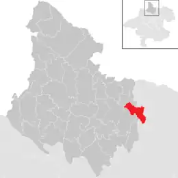 Location in the district | |
 Ahorn Location within Austria | |
| Coordinates: 48°31′26″N 14°10′30″E / 48.52389°N 14.17500°E | |
| Country | Austria |
| State | Upper Austria |
| District | Rohrbach |
| Area | |
| • Total | 13.03 km2 (5.03 sq mi) |
| Elevation | 828 m (2,717 ft) |
| Population (2018-01-01)[2] | |
| • Total | 505 |
| • Density | 39/km2 (100/sq mi) |
| Time zone | UTC+1 (CET) |
| • Summer (DST) | UTC+2 (CEST) |
| Postal code | 4184 |
| Area code | 07216 |
| Vehicle registration | RO |
Ahorn was a municipality in the district of Rohrbach in the Austrian state of Upper Austria.
Population
| Year | Pop. | ±% |
|---|---|---|
| 1869 | 805 | — |
| 1880 | 787 | −2.2% |
| 1890 | 691 | −12.2% |
| 1900 | 650 | −5.9% |
| 1910 | 633 | −2.6% |
| 1923 | 593 | −6.3% |
| 1934 | 590 | −0.5% |
| 1939 | 565 | −4.2% |
| 1951 | 525 | −7.1% |
| 1961 | 501 | −4.6% |
| 1971 | 503 | +0.4% |
| 1981 | 484 | −3.8% |
| 1991 | 493 | +1.9% |
| 2001 | 492 | −0.2% |
| 2011 | 492 | +0.0% |
| 2017 | 506 | +2.8% |
References
- ↑ "Dauersiedlungsraum der Gemeinden Politischen Bezirke und Bundesländer - Gebietsstand 1.1.2018". Statistics Austria. Retrieved 10 March 2019.
- ↑ "Einwohnerzahl 1.1.2018 nach Gemeinden mit Status, Gebietsstand 1.1.2018". Statistics Austria. Retrieved 9 March 2019.
This article is issued from Wikipedia. The text is licensed under Creative Commons - Attribution - Sharealike. Additional terms may apply for the media files.