al-Qutayfah District
منطقة القطيفة | |
|---|---|
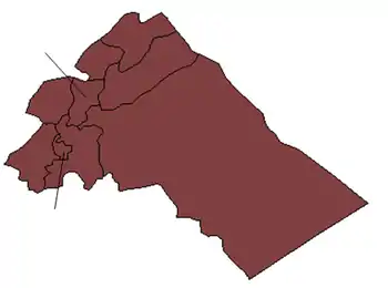
 Map of al-Qutayfah District within Rif Dimashq Governorate | |
| Coordinates (al-Qutayfah): 33°44′N 36°35′E / 33.73°N 36.58°E | |
| Country | |
| Governorate | Rif Dimashq |
| Seat | al-Qutayfah |
| Subdistricts | 4 nawāḥī |
| Area | |
| • Total | 1,587.63 km2 (612.99 sq mi) |
| Population (2004)[1] | |
| • Total | 119,283 |
| • Density | 75/km2 (190/sq mi) |
| Geocode | SY0303 |
al-Qutayfah District (Arabic: منطقة القطيفة, romanized: manṭiqat al-Qutayfah) is a district of the Rif Dimashq Governorate in southern Syria. Administrative centre is the city of al-Qutayfah. At the 2004 census, the district had a population of 119,283.[1]
Sub-districts
The district of al-Qutayfah is divided into four sub-districts or nawāḥī (population as of 2004[1]):
| Code | Name | Area | Population |
|---|---|---|---|
| SY030300 | al-Qutayfah Subdistrict | 270.68 km² | 44,820 |
| SY030301 | Jayroud Subdistrict | 382.07 km² | 31,821 |
| SY030302 | Maaloula Subdistrict | 226.06 km² | 12,192 |
| SY030303 | ar-Ruhaybah Subdistrict | 708.82 km² | 30,450 |
Localities in al-Qutayfah District
According to the Central Bureau of Statistics (CBS), the following villages, towns and cities make up the district of Al-Qutayfah:[1]
| English Name | Arabic Name | Population | Subdistrict |
|---|---|---|---|
| ar-Ruhaybah | الرحيبة | 30,450 | ar-Ruhaybah |
| al-Qutayfah | القطيفة | 26,671 | al-Qutayfah |
| Jayroud | جيرود | 24,219 | Jayroud |
| Muadamiyat al-Qalamoun | معضمية القلمون | 14,228 | al-Qutayfah |
| al-Naseriyah | الناصرية | 4,827 | Jayroud |
| Hala | حله | 3,921 | al-Qutayfah |
| Jubaadin | جبعدين | 3,778 | Maaloula |
| Ain al-Tinah | عين التينة | 3,206 | Maaloula |
| Maaloula | معلولا | 2,762 | Maaloula |
| al-Tawani | التواني | 2,446 | Maaloula |
| al-Aatanah | العطنة | 1,897 | Jayroud |
| al-Mansoura | المنصورة | 878 | Jayroud |
References
- 1 2 3 4 "General Census of Population and Housing 2004" (PDF) (in Arabic). Syrian Central Bureau of Statistics. Archived from the original (PDF) on 8 December 2015. Retrieved 15 October 2015. Also available in English: "Syria: 2004 census data". UN OCHA. Retrieved 15 October 2015.
|   | ||||||||||||||||||
|
| |||||||||||||||||||
| |||||||||||||||||||
| |||||||||||||||||||
| |||||||||||||||||||
| |||||||||||||||||||
| |||||||||||||||||||
| |||||||||||||||||||
| |||||||||||||||||||
This article is issued from Wikipedia. The text is licensed under Creative Commons - Attribution - Sharealike. Additional terms may apply for the media files.