as-Suwayda District
منطقة السويداء | |
|---|---|
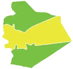 Map of as-Suwayda District within as-Suwayda Governorate | |
| Coordinates (as-Suwayda): 32°42′N 36°34′E / 32.7°N 36.57°E | |
| Country | |
| Governorate | as-Suwayda |
| Seat | as-Suwayda |
| Subdistricts | 3 nawāḥī |
| Area | |
| • Total | 2,804.22 km2 (1,082.72 sq mi) |
| Population (2004)[1] | |
| • Total | 180,907 |
| • Density | 65/km2 (170/sq mi) |
| Geocode | SY1300 |
as-Suwayda District (Arabic: منطقة السويداء, romanized: manṭiqat as-Suwaydā’) is a district of the as-Suwayda Governorate in southern Syria. The administrative centre is the city of as-Suwayda. At the 2004 census, the district had a population of 180,907.[1]
Sub-districts
The district of as-Suwayda is divided into three sub-districts or nawāḥī (population as of 2004[1]):
| Code | Name | Area | Population |
|---|---|---|---|
| SY130000 | as-Suwayda Subdistrict | 691.13 km2 | 212,463 |
| SY130001 | al-Mazraa Subdistrict | 202.53 km2 | 16,627 |
| SY130002 | al-Mushannaf Subdistrict | 1,910.57 km2 | 17,134 |
See also
References
- 1 2 3 "General Census of Population and Housing 2004" (PDF) (in Arabic). Syrian Central Bureau of Statistics. Archived from the original (PDF) on 8 December 2015. Retrieved 15 October 2015. Also available in English: "2004 Census Data". UN OCHA. Retrieved 15 October 2015.
| |||||||||||||||
| |||||||||||||||
| |||||||||||||||
This article is issued from Wikipedia. The text is licensed under Creative Commons - Attribution - Sharealike. Additional terms may apply for the media files.