Ampitatafika | |
|---|---|
 Ampitatafika Location in Madagascar | |
| Coordinates: 18°56′00″S 47°28′30″E / 18.93333°S 47.47500°E | |
| Country | |
| Region | Analamanga |
| District | Antananarivo-Atsimondrano |
| Area | |
| • Total | 21.8 km2 (8.4 sq mi) |
| Elevation | 1,255 m (4,117 ft) |
| Population (2018) | |
| • Total | 50,373 |
| Time zone | UTC3 (EAT) |
| postal code | 102 |
Ampitatafika is a suburb and a rural commune in Analamanga Region, in the Central Highlands of Madagascar. It belongs to the district of Antananarivo-Atsimondrano and its populations numbers to 50,373 in 2018.[2]
The National Road 1 crosses this suburb.
Rivers
The Sisaony[3] and the Ikopa River.
References
- ↑ Ampitatafika
- ↑ Recensement general de la population et de l'habitation de 2018 de Madagascar
- ↑ Midi-Madagasikara
Capital: Antananarivo | ||
| Ambohidratrimo (24) - 105 | 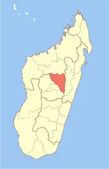 | |
| Andramasina (14) - 106 | ||
| Anjozorobe (18) - 107 | ||
| Ankazobe (15) - 108 | ||
| Antananarivo-Atsimondrano (26) - 102 |
| |
| Antananarivo-Avaradrano (16) - 103 | ||
| Antananarivo-Renivohitra (1) - 101 | ||
| Manjakandriana (23) - 116 | ||
8 districts; 137 communes | ||
This article is issued from Wikipedia. The text is licensed under Creative Commons - Attribution - Sharealike. Additional terms may apply for the media files.