Anan | |
|---|---|
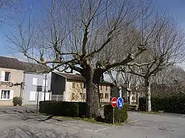 A street in Anan. | |
Location of Anan | |
 Anan  Anan | |
| Coordinates: 43°21′23″N 0°48′54″E / 43.3564°N 0.815°E | |
| Country | France |
| Region | Occitania |
| Department | Haute-Garonne |
| Arrondissement | Saint-Gaudens |
| Canton | Cazères |
| Intercommunality | Cœur et Coteaux du Comminges |
| Government | |
| • Mayor (2020–2026) | Laurent Briol[1] |
| Area 1 | 13.43 km2 (5.19 sq mi) |
| Population | 261 |
| • Density | 19/km2 (50/sq mi) |
| Time zone | UTC+01:00 (CET) |
| • Summer (DST) | UTC+02:00 (CEST) |
| INSEE/Postal code | 31008 /31230 |
| Elevation | 199–327 m (653–1,073 ft) (avg. 210 m or 690 ft) |
| 1 French Land Register data, which excludes lakes, ponds, glaciers > 1 km2 (0.386 sq mi or 247 acres) and river estuaries. | |
Anan (French pronunciation: [anɑ̃]) is a commune in the Haute-Garonne department in southwestern France.
Population
| Year | Pop. | ±% |
|---|---|---|
| 1962 | 231 | — |
| 1968 | 270 | +16.9% |
| 1975 | 269 | −0.4% |
| 1982 | 244 | −9.3% |
| 1990 | 238 | −2.5% |
| 1999 | 231 | −2.9% |
| 2008 | 223 | −3.5% |
See also
References
- ↑ "Répertoire national des élus: les maires". data.gouv.fr, Plateforme ouverte des données publiques françaises (in French). 2 December 2020.
- ↑ "Populations légales 2021". The National Institute of Statistics and Economic Studies. 28 December 2023.
Wikimedia Commons has media related to Anan (Haute-Garonne).
This article is issued from Wikipedia. The text is licensed under Creative Commons - Attribution - Sharealike. Additional terms may apply for the media files.