Angevillers | |
|---|---|
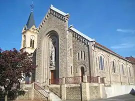 The church in Angevillers | |
 Coat of arms | |
Location of Angevillers | |
 Angevillers  Angevillers | |
| Coordinates: 49°23′19″N 6°02′36″E / 49.3886°N 6.0433°E | |
| Country | France |
| Region | Grand Est |
| Department | Moselle |
| Arrondissement | Thionville |
| Canton | Algrange |
| Intercommunality | CA Portes de France-Thionville |
| Government | |
| • Mayor (2020–2026) | Jean-Marie Colin[1] |
| Area 1 | 8.71 km2 (3.36 sq mi) |
| Population | 1,311 |
| • Density | 150/km2 (390/sq mi) |
| Time zone | UTC+01:00 (CET) |
| • Summer (DST) | UTC+02:00 (CEST) |
| INSEE/Postal code | 57022 /57440 |
| Elevation | 315–418 m (1,033–1,371 ft) (avg. 363 m or 1,191 ft) |
| 1 French Land Register data, which excludes lakes, ponds, glaciers > 1 km2 (0.386 sq mi or 247 acres) and river estuaries. | |
Angevillers (French pronunciation: [ɑ̃ʒvile]; German: Arsweiler; Lorraine Franconian Aasler, German: Arsweiler) is a commune in the Moselle department in Grand Est in northeastern France.
Population
| Year | Pop. | ±% p.a. |
|---|---|---|
| 1968 | 1,397 | — |
| 1975 | 1,441 | +0.44% |
| 1982 | 1,284 | −1.63% |
| 1990 | 1,175 | −1.10% |
| 1999 | 1,185 | +0.09% |
| 2009 | 1,281 | +0.78% |
| 2014 | 1,246 | −0.55% |
| 2020 | 1,264 | +0.24% |
| Source: INSEE[3] | ||

Former Hitler's HQ in the nearby forest
See also
- Communes of the Moselle department
- Ouvrage Rochonvillers, a Maginot Line fortification
References
- ↑ "Répertoire national des élus: les maires". data.gouv.fr, Plateforme ouverte des données publiques françaises (in French). 9 August 2021.
- ↑ "Populations légales 2021". The National Institute of Statistics and Economic Studies. 28 December 2023.
- ↑ Population en historique depuis 1968, INSEE
External links
 Media related to Angevillers at Wikimedia Commons
This article is issued from Wikipedia. The text is licensed under Creative Commons - Attribution - Sharealike. Additional terms may apply for the media files.