Anjiamangirana I | |
|---|---|
 Anjiamangirana I Location in Madagascar | |
| Coordinates: 15°10′S 47°47′E / 15.167°S 47.783°E | |
| Country | |
| Region | Sofia |
| District | Antsohihy |
| Elevation | 68 m (223 ft) |
| Population (2001)[2] | |
| • Total | 12,000 |
| Time zone | UTC3 (EAT) |
Anjiamangirana I is a rural municipality in Madagascar. It belongs to the district of Antsohihy, which is a part of Sofia Region. The population of the commune was estimated to be approximately 12,000 in 2001 commune census.[2]
Primary and junior level secondary education are available in town. The majority 60% of the population of the commune are farmers, while an additional 30% receives their livelihood from raising livestock. The most important crop is rice, while other important products are peanuts, maize and cassava. Services provide employment for 7% of the population. Additionally fishing employs 3% of the population.[2]
Roads
Anjiamangirana I is situated at the junction of RN 6 and a provincial road to Antonibe and the Anjajavy Forest.
References
- ↑ Estimated based on DEM data from Shuttle Radar Topography Mission
- 1 2 3 "ILO census data". Cornell University. 2002. Retrieved 2008-02-29.
Capital: Antsohihy | ||
| Analalava (11) (407) | 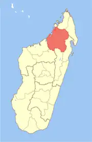 | |
| Antsohihy (12) (407) | ||
| Bealanana (13) (407) | ||
| Befandriana-Nord (12) (409) | ||
| Boriziny (15) (Port-Bergé) (419) |
| |
| Mampikony (6) (414) | ||
| Mandritsara (22) (415) | ||
7 districts; 91 communes | ||
15°10′S 47°47′E / 15.167°S 47.783°E