| Antietam Creek Tributary to Schuylkill River | |
|---|---|
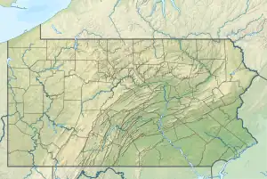 Location of Antietam Creek mouth  Antietam Creek (Schuylkill River tributary) (the United States) | |
| Location | |
| Country | United States |
| State | Pennsylvania |
| County | Berks |
| City | Reading |
| Physical characteristics | |
| Source | Little Manatawny Creek divide |
| • location | pond about 0.25 miles south of Alsace Manor, Pennsylvania |
| • coordinates | 40°23′27″N 075°51′15″W / 40.39083°N 75.85417°W[1] |
| • elevation | 785 ft (239 m)[2] |
| Mouth | |
• location | Southeastern Reading, Pennsylvania |
• coordinates | 40°16′58″N 075°50′51″W / 40.28278°N 75.84750°W[1] |
• elevation | 157 ft (48 m)[3] |
| Length | 10.01 mi (16.11 km)[4] |
| Basin size | 17.57 square miles (45.5 km2)[5] |
| Discharge | |
| • location | Schuylkill River |
| • average | 27.54 cu ft/s (0.780 m3/s) at mouth with Schuylkill River[5] |
| Basin features | |
| Progression | Schuylkill River → Delaware River → Delaware Bay → Atlantic Ocean |
| River system | Delaware River |
| Tributaries | |
| • left | unnamed tributaries |
| • right | unnamed tributaries |
| Waterbodies | Antietam Reservoir |
| Bridges | Mexico Road, Antietam Road, Seider Road, Angora Road, Antietam Road (x2), Heidelberg Avenue, Butler Lane, St. Lawrence Avenue, Oley Turnpike Road, Parkview Road, Gibralter Road, US 422 |
Antietam Creek is a 10.5-mile-long (16.9 km)[6] tributary of the Schuylkill River in Berks County, Pennsylvania. It rises just south of Alsace Manor in Alsace Township. There are several non-named tributaries to the creek. It empties into the Schuylkill just south of Reading.
See also
References
- 1 2 "GNIS Detail - Antietam Creek". geonames.usgs.gov. US Geological Survey. Retrieved 27 August 2021.
- ↑ "Get Maps". USGS Topoview. US Geological Survey. Retrieved 27 August 2021.
- ↑ "Get Maps". USGS Topoview. US Geological Survey. Retrieved 27 August 2021.
- ↑ "ArcGIS Web Application". epa.maps.arcgis.com. US EPA. Retrieved 27 August 2021.
- 1 2 "Antietam Creek Watershed Report". US EPA Geoviewer. US EPA. Retrieved 27 August 2021.
- ↑ U.S. Geological Survey. National Hydrography Dataset high-resolution flowline data. The National Map Archived 2012-03-29 at the Wayback Machine, accessed April 1, 2011
- Birdsboro 7.5 Minute Quadrangle, Department of the Interior, USGS.
- Fleetwood 7.5 Minute Quadrangle, Department of the Interior, USGS.
This article is issued from Wikipedia. The text is licensed under Creative Commons - Attribution - Sharealike. Additional terms may apply for the media files.