Ariquemes | |
|---|---|
Municipality | |
| The Municipality of Ariquemes | |
 Flag  Seal | |
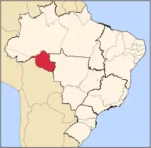
 Location of Ariquemes in the State of Rondônia | |
 Ariquemes Location of Ariquemes | |
| Coordinates: 09°54′58″S 63°02′27″W / 9.91611°S 63.04083°W | |
| Country | |
| Region | North |
| State | |
| Founded | November 21, 1977 |
| Government | |
| • Mayor | Thiago Leite Flores Pereira (PMDB) |
| Area | |
| • Total | 4,427 km2 (1,709 sq mi) |
| Elevation | 142 m (466 ft) |
| Population (2020 [1]) | |
| • Total | 109,523 |
| • Density | 25/km2 (64/sq mi) |
| Time zone | UTC−4 (AMT) |
| HDI (2000) | 0.752 – medium[2] |
| Website | www.ariquemes.ro.gov.br |
Ariquemes is a municipality located in the Brazilian state of Rondônia. Its population was 109,523 (2020 est.) and its area is 4,427 km2.[3] It is the third-largest city in Rondônia state.
Transportation
The city is served by Ariquemes Airport.
References
- ↑ IBGE 2020
- ↑ "Archived copy". Archived from the original on 2009-10-03. Retrieved 2009-12-17.
{{cite web}}: CS1 maint: archived copy as title (link) - UNDP - ↑ "Archived copy". Archived from the original on 2008-06-11. Retrieved 2008-06-11.
{{cite web}}: CS1 maint: archived copy as title (link) - IBGE
External links
- Official website (in Portuguese)
Capital: Porto Velho | ||||||||
| Porto Velho |
|  | ||||||
| Ji-Paraná |
| |||||||
This article is issued from Wikipedia. The text is licensed under Creative Commons - Attribution - Sharealike. Additional terms may apply for the media files.