Břvany | |
|---|---|
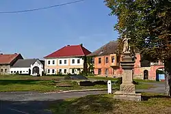 Centre of Břvany | |
 Flag  Coat of arms | |
 Břvany Location in the Czech Republic | |
| Coordinates: 50°24′4″N 13°43′18″E / 50.40111°N 13.72167°E | |
| Country | |
| Region | Ústí nad Labem |
| District | Louny |
| First mentioned | 1436 |
| Area | |
| • Total | 9.38 km2 (3.62 sq mi) |
| Elevation | 209 m (686 ft) |
| Population (2023-01-01)[1] | |
| • Total | 318 |
| • Density | 34/km2 (88/sq mi) |
| Time zone | UTC+1 (CET) |
| • Summer (DST) | UTC+2 (CEST) |
| Postal code | 440 01 |
| Website | www |
Břvany (German: Weberschan) is a municipality and village in Louny District in the Ústí nad Labem Region of the Czech Republic. It has about 300 inhabitants.
Břvany lies approximately 8 kilometres (5 mi) north-west of Louny, 36 km (22 mi) south-west of Ústí nad Labem, and 61 km (38 mi) north-west of Prague.
References
Wikimedia Commons has media related to Břvany.
This article is issued from Wikipedia. The text is licensed under Creative Commons - Attribution - Sharealike. Additional terms may apply for the media files.