37°11′27″N 80°36′29″W / 37.19083°N 80.60806°W[1]
Belspring, Virginia | |
|---|---|
Census-designated place (CDP) | |
 Post office | |
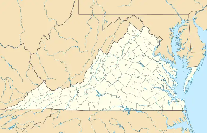 Belspring, Virginia Location of Belspring in Virginia | |
| Coordinates: 37°11′27″N 80°36′29″W / 37.19083°N 80.60806°W | |
| Country | United States |
| State | Virginia |
| County | Pulaski |
| Area | |
| • Total | 3.6 sq mi (9.3 km2) |
| • Land | 3.6 sq mi (9.3 km2) |
| • Water | 0 sq mi (0 km2) |
| Elevation | 1,778 ft (542 m) |
| Population (2000)[3] | |
| • Total | 176 |
| • Density | 49/sq mi (19/km2) |
| Time zone | UTC-5 (EST) |
| • Summer (DST) | UTC-4 (EDT) |
| ZIP code | 24058 (Pulaski) |
| Area code | 540[4] |
| FIPS code | 51155[5] |
| GNIS feature ID | 1481619[1] |
Belspring is a census-designated place (CDP) in Pulaski County, Virginia, United States, located at an elevation of 1,778 feet (542 m) above sea level.[1] It has the ZIP Code 24058 and the area code 540.[4] The population of the CDP was 256 at the 2010 Census.[6]
The John Hoge House was added to the National Register of Historic Places in 1988.[7]
References
- 1 2 3 4 U.S. Geological Survey Geographic Names Information System: Belspring, Virginia
- ↑ "ZIPskinny demographic information for 24058 - BELSPRING VIRGINIA". ZIPskinny. Retrieved 28 May 2010.
- ↑ "American FactFinder". U.S. Census Bureau. Archived from the original on 12 February 2020. Retrieved 28 May 2010.
- 1 2 "Find Area Code". White Pages. Retrieved 29 May 2010.
- ↑ "ZIP Code Lookup". ZIPinfo. Archived from the original on 14 June 2011. Retrieved 29 May 2010.
- ↑ Virginia Trend Report 2: State and Complete Places (Sub-state 2010 Census Data). Archived 2012-07-11 at archive.today Missouri Census Data Center. Accessed 2011-06-08.
- ↑ "National Register Information System". National Register of Historic Places. National Park Service. July 9, 2010.
Municipalities and communities of Pulaski County, Virginia, United States | ||
|---|---|---|
| Towns | 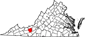 Map of Virginia highlighting Pulaski County | |
| CDPs | ||
| Unincorporated communities | ||
This article is issued from Wikipedia. The text is licensed under Creative Commons - Attribution - Sharealike. Additional terms may apply for the media files.