Bergschenhoek | |
|---|---|
Village | |
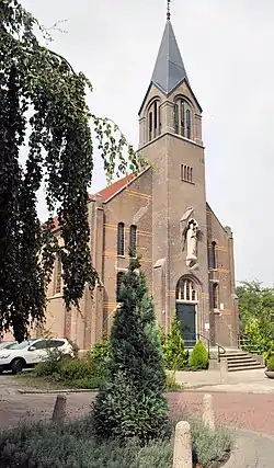 Sint Willibrorduskerk | |
 Flag  Seal | |
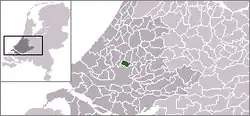 Location of Bergschenhoek in South Holland | |
 Bergschenhoek Location within the Netherlands | |
| Coordinates: 51°59′N 4°30′E / 51.98°N 4.50°E | |
| Country | |
| Province | |
| Municipality | |
| Area | |
| • Total | 15.52 km2 (5.99 sq mi) |
| • Land | 14.89 km2 (5.75 sq mi) |
| • Water | 0.63 km2 (0.24 sq mi) |
| Population (January 2020) | |
| • Total | 18,750 |
| • Density | 1,200/km2 (3,100/sq mi) |
| Time zone | UTC+1 (CET) |
| • Summer (DST) | UTC+2 (CEST) |
| Postal code | 2661 |
| Area code | 010 |
| Major roads | N209 |
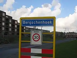
Bergschenhoek (Dutch pronunciation: [ˌbɛr(ə)xsə(n)ˈɦuk] ⓘ) is a town and former municipality in the municipality of Lansingerland, in the province of South Holland, Netherlands. It is situated roughly 10 km to the north of Rotterdam. The town had a population of 18,475 in 2019, and covered an area of 15.52 km2 (5.99 mile²) of which 0.63 km2 (0.24 mile²) is water. On 1 January 2007, the town was merged with neighbouring towns Berkel en Rodenrijs and Bleiswijk to form the new municipality Lansingerland; these three towns collectively are known locally as the "3B Hoek".
Due to the continuing influx of people to Bergschenhoek, it is in a constant state of expansion and is now predominantly a commuter town as most of its residents work in the neighbouring cities, such as The Hague and Rotterdam. The town had a large population increase since 1990, because of the Vinex-plans. The town grew from 7,600 inhabitants in 1990 to nearly 18,500 in 2019.
The name of the town is derived from a district of the nearby city of Rotterdam, Hillegersberg. There was a road leading to this municipality. On a corner of this road ('hoek' in Dutch) a settlement grew, leading to a village. This village was named after Hillegersberg, and the corner was incorporated in the name, hence the name (Hillegers)Bergschenhoek.
External links