Berzé-le-Châtel | |
|---|---|
Commune | |
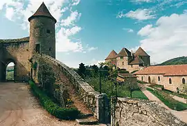 Castle | |
 Coat of arms | |
Location of Berzé-le-Châtel | |
 Berzé-le-Châtel 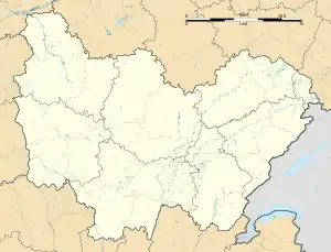 Berzé-le-Châtel | |
| Coordinates: 46°23′07″N 4°41′24″E / 46.3853°N 4.69°E | |
| Country | France |
| Region | Bourgogne-Franche-Comté |
| Department | Saône-et-Loire |
| Arrondissement | Mâcon |
| Canton | Cluny |
| Intercommunality | Clunisois |
| Area 1 | 5.53 km2 (2.14 sq mi) |
| Population | 57 |
| • Density | 10/km2 (27/sq mi) |
| Time zone | UTC+01:00 (CET) |
| • Summer (DST) | UTC+02:00 (CEST) |
| INSEE/Postal code | 71031 /71960 |
| Elevation | 304–590 m (997–1,936 ft) (avg. 349 m or 1,145 ft) |
| 1 French Land Register data, which excludes lakes, ponds, glaciers > 1 km2 (0.386 sq mi or 247 acres) and river estuaries. | |
Berzé-le-Châtel (French pronunciation: [bɛʁze lə ʃatɛl]; Arpitan: Bresié-le-Châtiô) is a commune in the Saône-et-Loire department in the region of Bourgogne-Franche-Comté in eastern France.
The trouvère Hugues IV de Berzé was the ruler of Berzé-le-Châtel in the early 13th century.
It is said that the castle's basement extends 1000 feet into the ground.
Population
| Year | Pop. | ±% p.a. |
|---|---|---|
| 1968 | 60 | — |
| 1975 | 81 | +4.38% |
| 1982 | 75 | −1.09% |
| 1990 | 65 | −1.77% |
| 1999 | 69 | +0.67% |
| 2009 | 62 | −1.06% |
| 2014 | 57 | −1.67% |
| 2020 | 59 | +0.58% |
| Source: INSEE[2] | ||
See also
References
External links
Wikimedia Commons has media related to Berzé-le-Châtel.
This article is issued from Wikipedia. The text is licensed under Creative Commons - Attribution - Sharealike. Additional terms may apply for the media files.