Bitam | |
|---|---|
 Coat of arms | |
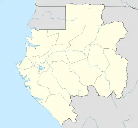 Bitam Location in Gabon | |
| Coordinates: 02°05′00″N 11°29′00″E / 2.08333°N 11.48333°E | |
| Country | |
| Province | Woleu-Ntem Province |
| Department | Ntem Department |
| Population (2013) | |
| • Total | 27,923 |
Bitam is a town in northern Gabon on the N2 road on the border with Cameroon.[1] As of the 2013 census, its population is 27,923.[2]
It is home to a large market and an airport.[3]
A small Jewish community composed of former Christians has developed in Bitam. The community practices Jewish customs, but does not yet have a synagogue.[4]
Climate
| Climate data for Bitam (1961–1990 normals, extremes 1946–present) | |||||||||||||
|---|---|---|---|---|---|---|---|---|---|---|---|---|---|
| Month | Jan | Feb | Mar | Apr | May | Jun | Jul | Aug | Sep | Oct | Nov | Dec | Year |
| Record high °C (°F) | 38.5 (101.3) |
40.5 (104.9) |
37.0 (98.6) |
38.0 (100.4) |
38.4 (101.1) |
38.5 (101.3) |
32.3 (90.1) |
38.0 (100.4) |
33.1 (91.6) |
36.0 (96.8) |
35.5 (95.9) |
35.0 (95.0) |
40.5 (104.9) |
| Mean daily maximum °C (°F) | 28.4 (83.1) |
30.3 (86.5) |
30.4 (86.7) |
30.3 (86.5) |
29.6 (85.3) |
28.3 (82.9) |
26.9 (80.4) |
26.9 (80.4) |
28.4 (83.1) |
28.7 (83.7) |
28.8 (83.8) |
28.7 (83.7) |
28.8 (83.8) |
| Daily mean °C (°F) | 24.2 (75.6) |
25.2 (77.4) |
25.2 (77.4) |
25.2 (77.4) |
24.9 (76.8) |
24.3 (75.7) |
23.4 (74.1) |
23.2 (73.8) |
24.1 (75.4) |
24.3 (75.7) |
24.3 (75.7) |
24.3 (75.7) |
24.4 (75.9) |
| Mean daily minimum °C (°F) | 20.0 (68.0) |
20.1 (68.2) |
20.0 (68.0) |
20.1 (68.2) |
20.2 (68.4) |
20.2 (68.4) |
19.9 (67.8) |
19.4 (66.9) |
19.8 (67.6) |
19.8 (67.6) |
19.7 (67.5) |
19.9 (67.8) |
19.9 (67.8) |
| Record low °C (°F) | 14.0 (57.2) |
13.2 (55.8) |
12.0 (53.6) |
14.4 (57.9) |
16.0 (60.8) |
15.5 (59.9) |
13.5 (56.3) |
14.8 (58.6) |
16.2 (61.2) |
17.0 (62.6) |
13.5 (56.3) |
14.5 (58.1) |
12.0 (53.6) |
| Average precipitation mm (inches) | 42.5 (1.67) |
72.6 (2.86) |
175.3 (6.90) |
119.2 (4.69) |
207.2 (8.16) |
131.8 (5.19) |
48.0 (1.89) |
63.9 (2.52) |
228.6 (9.00) |
282.2 (11.11) |
175.2 (6.90) |
59.7 (2.35) |
1,606.2 (63.24) |
| Average rainy days | 3.8 | 6.8 | 12.5 | 14.4 | 16.1 | 11.1 | 6.4 | 7.5 | 17.8 | 21.3 | 14.8 | 6.1 | 138.6 |
| Average relative humidity (%) | 80 | 78 | 79 | 81 | 82 | 83 | 85 | 84 | 82 | 83 | 83 | 83 | 82 |
| Mean monthly sunshine hours | 119.8 | 120.9 | 127.9 | 136.9 | 135.9 | 111.0 | 84.0 | 66.3 | 93.0 | 113.8 | 119.9 | 116.6 | 1,346 |
| Percent possible sunshine | 32 | 36 | 34 | 38 | 36 | 31 | 22 | 18 | 26 | 31 | 34 | 32 | 31 |
| Source 1: NOAA[5] | |||||||||||||
| Source 2: Meteo Climat (extremes)[6] | |||||||||||||
References
- ↑ West, Ben (2011). Cameroon. Bradt Travel Guides. p. 199. ISBN 978-1-84162-353-5.
- ↑ www.citypopulation.de, Retrieved on March 18, 2021
- ↑ Hickendorff, Annelies (19 September 2014). Gabon. Bradt Travel Guides. p. 147. ISBN 978-1-84162-554-6.
- ↑ "A SYNOPSIS OF THE JEWS OF SUB-SAHARAN AFRICA". Sub-Saharan African Synagogues. Retrieved 2023-03-16.
- ↑ "Bitam Climate Normals 1961–1990". National Oceanic and Atmospheric Administration. Retrieved March 8, 2015.
- ↑ "Station Bitam" (in French). Meteo Climat. Retrieved 11 June 2016.
This article is issued from Wikipedia. The text is licensed under Creative Commons - Attribution - Sharealike. Additional terms may apply for the media files.