Blanefield | |
|---|---|
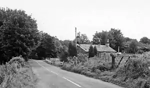 The site of the station in 1974 | |
| General information | |
| Location | Blanefield, Stirling Scotland |
| Coordinates | 55°59′16″N 4°19′35″W / 55.9878°N 4.3265°W |
| Grid reference | NS549796 |
| Platforms | 1 |
| Other information | |
| Status | Disused |
| History | |
| Original company | North British Railway |
| Post-grouping | LNER British Railways (Scottish Region) |
| Key dates | |
| 1 July 1867 | Opened |
| 1 October 1951 | Closed to passengers |
| 5 October 1959 | Closed to goods |
Blanefield railway station served the village of Blanefield, Stirling, Scotland from 1867 to 1959 on the Blane Valley Railway.
History
The station opened on 1 July 1867 by the North British Railway. The signal box, which opened in 1894, was to the west next to the level crossing. The station closed to passengers on 1 October 1951.[1] Goods traffic continued until 5 October 1959.[2]
References
- ↑ "Blanefield, Station Road, Blanefield Station". Canmore. Retrieved 23 December 2019.
- ↑ "Blanefield Station (remains) © Ben Brooksbank cc-by-sa/2.0 :: Geograph Britain and Ireland". Geograph. Retrieved 21 February 2021.
External links
| Preceding station | Disused railways | Following station | ||
|---|---|---|---|---|
| Dumgoyne Line and station closed |
North British Railway Blane Valley Railway |
Strathblane Line and station closed |
This article is issued from Wikipedia. The text is licensed under Creative Commons - Attribution - Sharealike. Additional terms may apply for the media files.