Bolotwa | |
|---|---|
 Landscape near the town of Bolotwa | |
 Bolotwa  Bolotwa | |
| Coordinates: 31°58′59″S 27°13′08″E / 31.983°S 27.219°E | |
| Country | South Africa |
| Province | Eastern Cape |
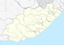
| District | Chris Hani |
| Municipality | Intsika Yethu |
| Area | |
| • Total | 4.72 km2 (1.82 sq mi) |
| Population (2011)[1] | |
| • Total | 610 |
| • Density | 130/km2 (330/sq mi) |
| Racial makeup (2011) | |
| • Black African | 100.0% |
| First languages (2011) | |
| • Xhosa | 98.5% |
| • Other | 1.5% |
| Time zone | UTC+2 (SAST) |
| PO box | 5325 |
| Area code | 047 |
Bolotwa (also spelled Bolotwe, and officially renamed Bholothwa in 2004)[2] is a town in Eastern Cape, South Africa.[3] It is the birthplace of African National Congress leader Robert Resha.[4]
References
- 1 2 3 4 "Main Place Bolotwa". Census 2011.
- ↑ "Approval of official place names" (PDF). gov.za. Retrieved 8 September 2023.
- ↑ "Bolotwa Map — Satellite Images of Bolotwa". Retrieved 30 March 2013.
- ↑ "Robert M. Resha". South African History Online. Retrieved 13 March 2013.
Municipalities and communities of Chris Hani District Municipality, Eastern Cape | ||
|---|---|---|
District seat: Queenstown (Komani) | ||
| Intsika Yethu | .svg.png.webp) Chris Hani District within South Africa | |
| Enoch Mgijima | ||
| Engcobo |
| |
| Emalahleni |
| |
| Inxuba Yethemba | ||
| Sakhisizwe | ||
This article is issued from Wikipedia. The text is licensed under Creative Commons - Attribution - Sharealike. Additional terms may apply for the media files.