Boylston, Alabama | |
|---|---|
 Boylston  Boylston | |
| Coordinates: 32°25′42″N 86°16′46″W / 32.42833°N 86.27944°W | |
| Country | United States |
| State | Alabama |
| County | Montgomery |
| Elevation | 217 ft (66 m) |
| Time zone | UTC-6 (Central (CST)) |
| • Summer (DST) | UTC-5 (CDT) |
| Area code | 334 |
| GNIS feature ID | 114799[1] |
Boylston is a former unincorporated community in Montgomery County, Alabama, United States, that is now a neighborhood within the city of Montgomery, between the city's downtown and the Tallapoosa River.
History
The community was likely named after a local family.[2] A post office opened under the name Boylston in 1827.[3]
References
- Encyclopædia Britannica Atlas, 1958 Edition, Plate 72.
- ↑ "Boylston". Geographic Names Information System. United States Geological Survey, United States Department of the Interior.
- ↑ Foscue, Virginia (1989). Place Names in Alabama. Tuscaloosa: The University of Alabama Press. p. 22. ISBN 0-8173-0410-X.
- ↑ "Montgomery County". Jim Forte Postal History. Retrieved January 16, 2015.
Municipalities and communities of Montgomery County, Alabama, United States | ||
|---|---|---|
| Cities | 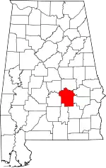 Map of Alabama highlighting Montgomery County | |
| Towns | ||
| Unincorporated communities | ||
| Indian reservation | ||
| Footnotes | ‡This populated place also has portions in an adjacent county or counties | |
This article is issued from Wikipedia. The text is licensed under Creative Commons - Attribution - Sharealike. Additional terms may apply for the media files.