Bud | |
|---|---|
Census-designated place (CDP) | |
 Post office | |
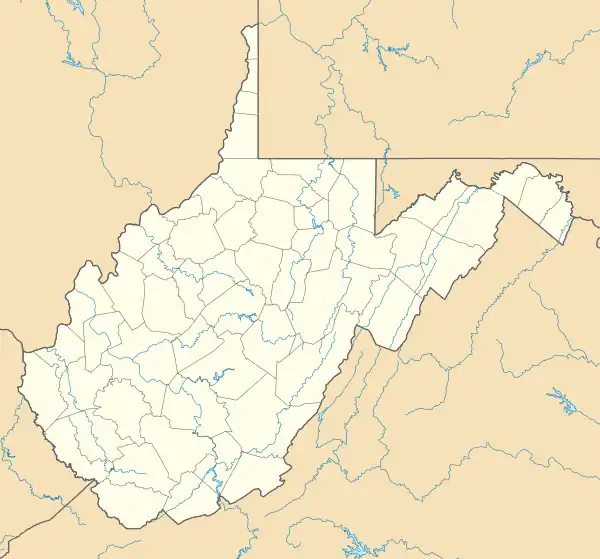 Bud Location within the state of West Virginia | |
| Coordinates: 37°32′10″N 81°22′47″W / 37.53611°N 81.37972°W | |
| Country | United States |
| State | West Virginia |
| County | Wyoming |
| Area | |
| • Total | 3.147 sq mi (8.15 km2) |
| • Land | 3.122 sq mi (8.09 km2) |
| • Water | 0.025 sq mi (0.06 km2) |
| Population | |
| • Total | 487 |
| • Density | 150/sq mi (60/km2) |
| Time zone | UTC-5 (Eastern (EST)) |
| • Summer (DST) | UTC-4 (EDT) |
| ZIP codes | 24716 |
Bud is a census-designated place (CDP) in Wyoming County, West Virginia, United States, along Barkers Creek and West Virginia Route 10.[3] As of the 2010 census, its population was 487.[2]
The community has the name of Bud Adams, a businessperson in the local logging industry.[4]
References
- ↑ "US Gazetteer files: 2010, 2000, and 1990". United States Census Bureau. 2011-02-12. Retrieved 2011-04-23.
- 1 2 "U.S. Census website". United States Census Bureau. Retrieved 2011-05-14.
- ↑ West Virginia Atlas & Gazetteer. Yarmouth, Me.: DeLorme. 1997. p. 58. ISBN 0-89933-246-3.
- ↑ Kenny, Hamill (1945). West Virginia Place Names: Their Origin and Meaning, Including the Nomenclature of the Streams and Mountains. Piedmont, WV: The Place Name Press. p. 137.
Municipalities and communities of Wyoming County, West Virginia, United States | ||
|---|---|---|
| City | 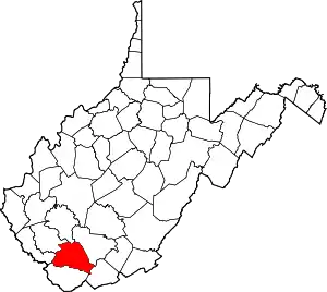 Map of West Virginia highlighting Wyoming County | |
| Towns | ||
| CDPs | ||
| Unincorporated communities |
| |
| Footnotes | ‡This populated place also has portions in an adjacent county or counties | |
This article is issued from Wikipedia. The text is licensed under Creative Commons - Attribution - Sharealike. Additional terms may apply for the media files.