 | ||||
|---|---|---|---|---|
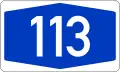
| Bundesautobahn 113 | ||||
 | ||||
| Route information | ||||
| Length | 19.1 km (11.9 mi) | |||
| Major junctions | ||||
| North end | ||||
| South end | ||||
| Location | ||||
| Country | Germany | |||
| States | Berlin, Brandenburg | |||
| Highway system | ||||
| ||||
| ||||
Bundesautobahn 113 (translates from German as Federal Motorway 113, short form Autobahn 113, abbreviated as BAB 113 or A 113) is a motorway in Germany. The motorway, located within Berlin, connects Neukölln (from the A 100) to Schönefeld (ends to the A 10). Its last segment opened on 23 May 2008.[1]
The route of the motorway follows, in parts, the former Berlin Wall. The motorway was proposed in 1992 and began construction in 1997. The first segment opened in 2004, and a second segment opened in 2008.
Exit list
| (1) | Neukölln 3-way interchange | |
| (2) | Späthstraße | |
| (3) | Johannisthaler Chaussee | |
| (4) | Stubenrauchstraße | |
| (5) | Adlershof | |
| Teltowkanalbrücke 149 m | ||
| Tunnel Rudower Höhe 904 m | ||
| Tunnel Alt-Glienicke 304 m | ||
| (6) | Schönefeld-Nord (Nordteil) | |
| (7) | Schönefeld-Süd (Nordteil) | |
| (6) | Schönefeld-Nord (Südteil) | |
| (7) | Schönefeld-Süd (Südteil) | |
| (8) | Flughafen Berlin-Brandenburg | |
| (9) | Waltersdorfer 3-way interchange | |
| (10) | Schönefelder Kreuz 4-way interchange |
References
- ↑ Senatsverwaltung für Stadtentwicklung. "Verkehrsfreigabe am 23. Mai 2008" [To traffic on 23 May 2008] (in German). Berlin. Archived from the original on 14 October 2013. Retrieved 22 July 2010.
External links
Wikimedia Commons has media related to Bundesautobahn 113.
- Bundesautobahn 113 – detailed route plan (in German)
This article is issued from Wikipedia. The text is licensed under Creative Commons - Attribution - Sharealike. Additional terms may apply for the media files.