This list includes properties and districts listed on the California Historical Landmark listing in Modoc County, California. Click the "Map of all coordinates" link to the right to view a Google map of all properties and districts with latitude and longitude coordinates in the table below.
| Image | [1] | Landmark name | Location | City or town | Summary |
|---|---|---|---|---|---|
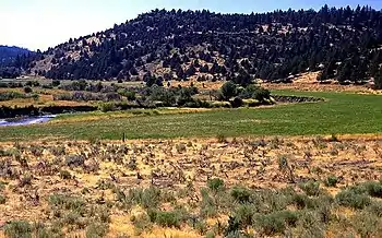
 Battle of Land's Ranch |
108 | Battle of Land's Ranch | State Hwy. 139, 0.1 mi. S. of jct. with Old Alturas Hwy. (Co. Rd. 114) 41°50′32″N 121°18′30″W / 41.8421888888889°N 121.308425°W |
||
 Bloody Point |
8 | Bloody Point | 2.9 mi. S. of Oregon border on Old Alturas Hwy. (Co. Rd. 114), then 0.7 mi. W. on Co. Rd. 104 at J Canal crossing 41°57′25″N 121°21′17″W / 41.9568138888889°N 121.354752777778°W |
||
 Bonner Grade |
15 | Bonner Grade | Cedar Pass, 6.2 mi. W. of Cedarville on State Hwy. 299 41°33′38″N 120°16′06″W / 41.5605138888889°N 120.268263888889°W |
Cedarville | |
 Chimney Rock |
109 | Chimney Rock | U.S. Hwy. 395 41°35′46″N 120°25′26″W / 41.596217°N 120.4239°W |
Alturas | |
 Cressler and Bonner Trading Post |
14 | Cressler and Bonner Trading Post | Cedarville Park 41°31′44″N 120°10′26″W / 41.528933°N 120.173833°W |
Cedarville | |
 Evans and Bailey Fight |
125 | Evans and Bailey Fight | Hilltop, 500 ft. S. of Centerville Rd., 4.9 mi. S.E. of Canby 41°24′56″N 120°48′09″W / 41.41565°N 120.802567°W |
Canby | |
 Fandango Pass |
546 | Fandango Pass | 3.8 mi. W. of Surprise Valley Rd. (Co. Rd. 1) on Fandango Pass Rd. (Co. Rd. 9) 41°48′08″N 120°12′25″W / 41.802114°N 120.206895°W |
Fort Bidwell | |
 Fort Bidwell |
430 | Fort Bidwell | Fort Bidwell Indian Community Center, W. end of Bridge St. 41°51′31″N 120°09′32″W / 41.85865°N 120.158812°W |
Fort Bidwell | |
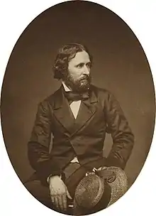
 Fremont's Camp |
6 | Fremont's Camp | Old Alturas Hwy. (Co. Rd. 114), 0.7 mi. north of jct. with State Hwy. 139 41°51′16″N 121°18′52″W / 41.8545442°N 121.3144719°W |
Copic | |
.jpg.webp) Infernal Caverns Battleground |
16 | Infernal Caverns Battleground | Ferry Ranch 41°16′20″N 120°34′34″W / 41.272222°N 120.576111°W |
Likely | |
 Old Emigrant Trail |
111 | Old Emigrant Trail | N.W. of Co. Rd. 84 41°25′07″N 120°59′48″W / 41.418494°N 120.996573°W |
Canby | |
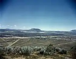
 Tule Lake War Relocation Center |
850-2 | Tule Lake War Relocation Center | State Hwy. 139 and Co. Rd. 176 41°53′07″N 121°22′29″W / 41.8854027777778°N 121.37465°W |
Newell |
References
- ↑ "California Historical Landmarks By County". Ohp.parks.ca.gov. Retrieved 2019-04-03.
See also
Wikimedia Commons has media related to California Historical Landmarks in Modoc County, California.
This article is issued from Wikipedia. The text is licensed under Creative Commons - Attribution - Sharealike. Additional terms may apply for the media files.