This list includes properties and districts listed on the California Historical Landmark listing in Stanislaus County, California. Click the "Map of all coordinates" link to the right to view a Google map of all properties and districts with latitude and longitude coordinates in the table below.
| Image | [1] | Landmark name | Location | City or town | Summary |
|---|---|---|---|---|---|
Empire City |
418 | Empire City | Empire Community Park 37°38′14″N 120°54′10″W / 37.637317°N 120.902783°W / 37.637317; -120.902783 (Empire City) |
Empire | |
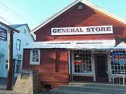 Knights Ferry |
347 | Knights Ferry | Historic district 37°49′08″N 120°40′19″W / 37.818889°N 120.671944°W / 37.818889; -120.671944 (Knights Ferry) |
Knights Ferry | Also on the NRHP list as NPS-75000490 |
 La Grange |
414 | La Grange | Historic district 37°39′49″N 120°27′49″W / 37.663611°N 120.463611°W / 37.663611; -120.463611 (La Grange) |
La Grange | |
 Turlock Assembly Center |
934 | Turlock Assembly Center | Stanislaus County Fairgrounds 37°30′06″N 120°51′28″W / 37.5017166666667°N 120.857763888889°W / 37.5017166666667; -120.857763888889 (Turlock Assembly Center) |
Turlock | |
 Willms Ranch |
415 | Willms Ranch | Willms Rd, 1.3 mi S of State Hwy 120 37°48′01″N 120°38′44″W / 37.8002861111111°N 120.645622°W / 37.8002861111111; -120.645622 (Willms Ranch) |
Knights Ferry |
References
- ↑ "California Historical Landmarks By County". Ohp.parks.ca.gov. Retrieved 2019-04-03.
See also
Wikimedia Commons has media related to California Historical Landmarks in Stanislaus County, California.
- List of California Historical Landmarks
- National Register of Historic Places listings in Stanislaus County, California
This article is issued from Wikipedia. The text is licensed under Creative Commons - Attribution - Sharealike. Additional terms may apply for the media files.