Camplong | |
|---|---|
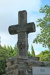 The cross of 1657 | |
Location of Camplong | |
 Camplong  Camplong | |
| Coordinates: 43°40′25″N 3°07′09″E / 43.6736°N 3.1192°E | |
| Country | France |
| Region | Occitania |
| Department | Hérault |
| Arrondissement | Béziers |
| Canton | Clermont-l'Hérault |
| Government | |
| • Mayor (2020–2026) | Bernard Coste[1] |
| Area 1 | 13.25 km2 (5.12 sq mi) |
| Population | 221 |
| • Density | 17/km2 (43/sq mi) |
| Time zone | UTC+01:00 (CET) |
| • Summer (DST) | UTC+02:00 (CEST) |
| INSEE/Postal code | 34049 /34260 |
| Elevation | 264–882 m (866–2,894 ft) (avg. 247 m or 810 ft) |
| 1 French Land Register data, which excludes lakes, ponds, glaciers > 1 km2 (0.386 sq mi or 247 acres) and river estuaries. | |
Camplong (French pronunciation: [kɑ̃plɔ̃]) is a commune in the Hérault department in southern France.

Map
Personalities
- Ferdinand Fabre spent part of his youth at the house of his uncle, who was curate of the parish.
Population
| Year | Pop. | ±% p.a. |
|---|---|---|
| 1968 | 348 | — |
| 1975 | 305 | −1.87% |
| 1982 | 251 | −2.75% |
| 1990 | 241 | −0.51% |
| 1999 | 187 | −2.78% |
| 2009 | 239 | +2.48% |
| 2014 | 238 | −0.08% |
| 2020 | 227 | −0.79% |
| Source: INSEE[3] | ||
See also
References
- ↑ "Répertoire national des élus: les maires". data.gouv.fr, Plateforme ouverte des données publiques françaises (in French). 2 December 2020.
- ↑ "Populations légales 2021". The National Institute of Statistics and Economic Studies. 28 December 2023.
- ↑ Population en historique depuis 1968, INSEE
Wikimedia Commons has media related to Camplong (Hérault).
This article is issued from Wikipedia. The text is licensed under Creative Commons - Attribution - Sharealike. Additional terms may apply for the media files.