Cantagallo | |
|---|---|
 Seal | |
.svg.png.webp) Location in Salamanca | |
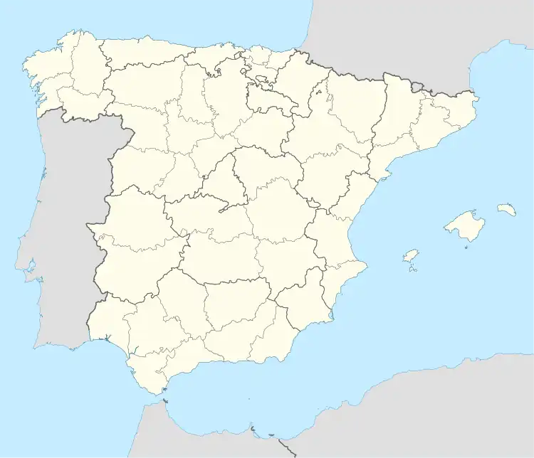 Cantagallo Location in Spain | |
| Coordinates: 40°22′23″N 5°49′11″W / 40.37306°N 5.81972°W | |
| Country | Spain |
| Autonomous community | Castile and León |
| Province | Salamanca |
| Comarca | Sierra de Béjar |
| Government | |
| • Mayor | Adolfo Álvarez de Castro (People's Party) |
| Area | |
| • Total | 8 km2 (3 sq mi) |
| Elevation | 932 m (3,058 ft) |
| Population (2018)[2] | |
| • Total | 260 |
| • Density | 33/km2 (84/sq mi) |
| Time zone | UTC+1 (CET) |
| • Summer (DST) | UTC+2 (CEST) |
| Postal code | 37792 |
Cantagallo is a village and municipality in the province of Salamanca, western Spain, part of the autonomous community of Castile-Leon. It is located 90 kilometres (56 mi) from the city of Salamanca and as of 2016 has a population of 263 people. The municipality covers an area of 87.51 km2 (33.79 sq mi), and lies 932 metres (3,058 ft) above sea level. The postal code is 37792.
References
- 1 2 "Municipio:Cantagallo". www.lasalina.es (in Spanish). Retrieved 2017-11-01.
- ↑ Municipal Register of Spain 2018. National Statistics Institute.
This article is issued from Wikipedia. The text is licensed under Creative Commons - Attribution - Sharealike. Additional terms may apply for the media files.