Centralia Township | |
|---|---|
| Coordinates: 39°11′50″N 92°09′11″W / 39.19732°N 92.15312°W[1] | |
| Country | United States |
| State | Missouri |
| County | Boone |
| Area | |
| • Total | 30.6 sq mi (79 km2) |
| • Land | 30.5 sq mi (79 km2) |
| • Water | 0.1 sq mi (0.3 km2) |
| Population (2012) | |
| • Total | 4,674 |
| • Density | 150/sq mi (59/km2) |
| Area code | 573 |
| GNIS Feature ID | 766331 |
Centralia Township is one of ten townships in Boone County, Missouri, USA. As of the 2012, its population was 4,674.[2] The township is dominated by the railroad city of Centralia for which it is named.
History
Centralia Township was established in 1874.[3]
Geography
Centralia Township covers an area of 30.6 square miles (79 km2) and is located in the extreme northeast corner of Boone County. The township contains one incorporated settlement: Centralia. Though the township primarily drains into the Missouri River the extreme northern part drains into the Mississippi River via the Salt River.
References
- ↑ "Township of Centralia". Geographic Names Information System. United States Geological Survey. Retrieved January 16, 2014.
- ↑ "Centralia township, Boone County, Missouri". United States Census Bureau. Retrieved August 24, 2013.
- ↑ "Boone County Place Names, 1928–1945 (archived)". The State Historical Society of Missouri. Archived from the original on June 24, 2016. Retrieved September 4, 2016.
{{cite web}}: CS1 maint: bot: original URL status unknown (link)
External links
Municipalities and communities of Boone County, Missouri, United States | ||
|---|---|---|
| Cities | 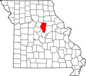 Map of Missouri highlighting Boone County | |
| Villages | ||
| Townships | ||
| Unincorporated communities | ||
| Ghost towns | ||
| Footnotes | ‡a small part of Centralia is in Audrain County | |
This article is issued from Wikipedia. The text is licensed under Creative Commons - Attribution - Sharealike. Additional terms may apply for the media files.