Château-l'Hermitage | |
|---|---|
.JPG.webp) The old priory | |
.svg.png.webp) Coat of arms | |
Location of Château-l'Hermitage | |
 Château-l'Hermitage 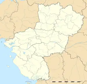 Château-l'Hermitage | |
| Coordinates: 47°48′16″N 0°10′57″E / 47.8044°N 0.1825°E | |
| Country | France |
| Region | Pays de la Loire |
| Department | Sarthe |
| Arrondissement | La Flèche |
| Canton | Le Lude |
| Intercommunality | Sud Sarthe |
| Government | |
| • Mayor (2020–2026) | Jean-Luc Loriot[1] |
| Area 1 | 9.39 km2 (3.63 sq mi) |
| Population | 254 |
| • Density | 27/km2 (70/sq mi) |
| Demonym(s) | Castelien, Castelienne |
| Time zone | UTC+01:00 (CET) |
| • Summer (DST) | UTC+02:00 (CEST) |
| INSEE/Postal code | 72072 /72510 |
| Elevation | 51–112 m (167–367 ft) |
| 1 French Land Register data, which excludes lakes, ponds, glaciers > 1 km2 (0.386 sq mi or 247 acres) and river estuaries. | |
Château-l'Hermitage is a commune in the Sarthe department in the Pays de la Loire region in north-western France.
See also
References
- ↑ "Répertoire national des élus: les maires". data.gouv.fr, Plateforme ouverte des données publiques françaises (in French). 2 December 2020.
- ↑ "Populations légales 2021". The National Institute of Statistics and Economic Studies. 28 December 2023.
Wikimedia Commons has media related to Château-l'Hermitage.
This article is issued from Wikipedia. The text is licensed under Creative Commons - Attribution - Sharealike. Additional terms may apply for the media files.