Chesapeake, Missouri | |
|---|---|
 Location of Chesapeake in Missouri | |
| Country | United States |
| State | Missouri |
| County | Lawrence |
| Area | |
| • Total | 0.45 sq mi (1.16 km2) |
| • Land | 0.45 sq mi (1.15 km2) |
| • Water | 0.00 sq mi (0.00 km2) |
| Population (2020) | |
| • Total | 48 |
| • Density | 107.87/sq mi (41.62/km2) |
| FIPS code | 29-13582 |
| GNIS feature ID | 2587059[2] |
Chesapeake is an unincorporated community and census-designated place in Lawrence County, Missouri, United States.[2] It is located on Route 174, approximately five miles east of Mount Vernon.
Chesapeake currently houses a fish hatchery, operated by the Missouri Department of Conservation.
A post office called Chesapeake was established in 1850, and remained in operation until 1914.[3] The community's name commemorates the Capture of USS Chesapeake.[4]
Demographics
| Census | Pop. | Note | %± |
|---|---|---|---|
| 2020 | 48 | — | |
| U.S. Decennial Census[5] | |||
References
- ↑ "ArcGIS REST Services Directory". United States Census Bureau. Retrieved September 5, 2022.
- 1 2 U.S. Geological Survey Geographic Names Information System: Chesapeake, Missouri
- ↑ "Post Offices". Jim Forte Postal History. Retrieved October 25, 2016.
- ↑ "Lawrence County Place Names, 1928–1945 (archived)". The State Historical Society of Missouri. Archived from the original on June 24, 2016. Retrieved October 25, 2016.
{{cite web}}: CS1 maint: bot: original URL status unknown (link) - ↑ "Census of Population and Housing". Census.gov. Retrieved June 4, 2016.
Municipalities and communities of Lawrence County, Missouri, United States | ||
|---|---|---|
| Cities | 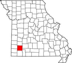 Map of Missouri highlighting Lawrence County | |
| Villages | ||
| Townships | ||
| CDP | ||
| Other communities | ||
| Ghost town | ||
| Footnotes | ‡This populated place also has portions in an adjacent county or counties | |
37°07′01″N 93°40′54″W / 37.11694°N 93.68167°W
This article is issued from Wikipedia. The text is licensed under Creative Commons - Attribution - Sharealike. Additional terms may apply for the media files.