Clem, West Virginia | |
|---|---|
 Clem, West Virginia  Clem, West Virginia | |
| Coordinates: 38°38′03″N 80°54′51″W / 38.63417°N 80.91417°W | |
| Country | United States |
| State | West Virginia |
| County | Braxton |
| Elevation | 978 ft (298 m) |
| Time zone | UTC-5 (Eastern (EST)) |
| • Summer (DST) | UTC-4 (EDT) |
| Area code(s) | 304 & 681 |
| GNIS feature ID | 1549631[1] |
Clem is a rural unincorporated community in Braxton County, West Virginia, United States. Clem is located along County Route 30, 11.25 miles (18.11 km) west-southwest of Sutton.[2]
A post office was established at this location in 1913. Clemuel Baxter Hart (1881-1960), the first postmaster, gave the community its name.[3][4]
References
- ↑ "Clem". Geographic Names Information System. United States Geological Survey, United States Department of the Interior.
- ↑ Braxton County, West Virginia General Highway Map (PDF) (Map). West Virginia Department of Transportation. 2011. p. 2. Archived from the original (PDF) on April 25, 2012. Retrieved March 8, 2012.
- ↑ Kenny, Hamill (1945). West Virginia Place Names: Their Origin and Meaning, Including the Nomenclature of the Streams and Mountains. Piedmont, WV: The Place Name Press. p. 175.
- ↑ Certificate of Death, Clemuel B. Hart
Municipalities and communities of Braxton County, West Virginia, United States | ||
|---|---|---|
| Towns | 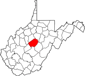 Map of West Virginia Strange Creek, West Virginiahighlighting Braxton County | |
| Unincorporated communities |
| |
| Ghost towns | ||
| Footnotes | ‡This populated place also has portions in an adjacent county or counties | |
This article is issued from Wikipedia. The text is licensed under Creative Commons - Attribution - Sharealike. Additional terms may apply for the media files.