Clover Hill, Mississippi | |
|---|---|
 Clover Hill  Clover Hill | |
| Coordinates: 34°16′30″N 90°32′39″W / 34.27500°N 90.54417°W | |
| Country | United States |
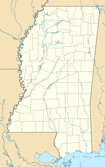
| State | Mississippi |
| County | Coahoma |
| Elevation | 131 ft (40 m) |
| Time zone | UTC-6 (Central (CST)) |
| • Summer (DST) | UTC-5 (CDT) |
| ZIP code | 38645 |
| Area code | 662 |
| GNIS feature ID | 691772[1] |
Clover Hill is an unincorporated community located in Coahoma County, Mississippi, United States. Clover Hill is approximately 4 miles (6.4 km) north of Lyon and approximately 4 miles (6.4 km) south of Rudyard. The community is located on the former plantation of J. T. Fargason.[2] Clover Hill once had a depot on the former Yazoo and Mississippi Valley Railroad.[3] A post office operated under the name Clover Hill from 1884 to 1935.[4]
The Clover Hill archaeological site is named after the community.[5]
References
- ↑ U.S. Geological Survey Geographic Names Information System: Clover Hill, Mississippi
- ↑ Rowland, Dunbar (1907). Mississippi: Comprising Sketches of Counties, Towns, Events, Institutions, and Persons, Arranged in Cyclopedic Form. Vol. 1. Southern Historical Publishing Association. p. 460.
- ↑ Howe, Tony. "Clover Hill, Mississippi". Mississippi Rails. Retrieved June 3, 2020.
- ↑ "Coahoma County". Jim Forte Postal History. Retrieved June 3, 2020.
- ↑ James F. Barnett Jr. (April 4, 2012). Mississippi's American Indians. University Press of Mississippi. p. 62. ISBN 978-1-62846-982-0.
Municipalities and communities of Coahoma County, Mississippi, United States | ||
|---|---|---|
| City | 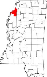 Map of Mississippi highlighting Coahoma County | |
| Towns | ||
| CDPs | ||
| Other communities | ||
| Ghost towns | ||
| Footnotes | ‡This populated place also has portions in an adjacent county or counties | |
This article is issued from Wikipedia. The text is licensed under Creative Commons - Attribution - Sharealike. Additional terms may apply for the media files.